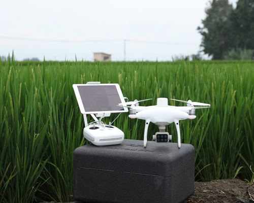
Pros & Cons of the Phantom 4 Multispectral
Pros & Cons of the Phantom 4 Multispectral. The phantom series is a staple of the DJI suite. The Phantom 1 was the company’s first widely commercially available drone and it has seen significant developments in the last decade since its 2013 launch. Today the Phantom comes in three categories, Pro, RTK and Multispectral with the Multispectral edition also coming with the in-built RTK unit.
The Phantom 4 Pro Multispectral (P4M) boasts both a high quality multispectral sensor as well as an RTK unit for accurate image positioning. Here we will discuss some of the main pros and cons of this multispectral solution.
Multispectral Mapping
Most people are familiar with red, green and blue (RGB) images. They make up the vast majority of images captured as they best represent the world as we see it with our eyes. These colours are within the visible part of the electromagnetic spectrum.
The term ‘multispectral’ refers to the process of isolating particular wavelengths of light on the electromagnetic spectrum. These isolated wavelengths can then be used to extract very useful data from the environment. Data that is not acquired by using just RBG imaging.
Environmental impact assessments, forest and sea biomass studies, farming analysis and even mineral deposit detection are just some of the specific and highly beneficial use cases of multispectral mapping.
Pros & Cons of the Phantom 4 Multispectral
RTK Unit
The inclusion of the RTK unit is a huge advantage of this platform. The unit provides centimetre level accuracies with little requirement for ground control. One potential downside to this however is that it increases the barrier to entry in terms of cost. Unlike the Mavic series where the RTK unit is modular and optional, the P4M comes with the inbuilt RTK unit as standard. DJI have likely done this as the main use case of this mapping is large scale farming.
Sensors
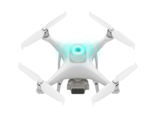
The P4M sensors are made up of a Red Edge, Near-Infrared, Red, Green, Blue and RGB sensor mounted on a 3-axis stabilised gimbal. Right away one of the advantages is that the payload does not forget about the regular RGB sensor while simultaneously capturing images at five individual wavelengths of light.
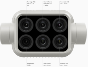
Each of the six sensors sit inside the housing at a size of 1/2.9 inches. For strictly RBG based images this is a definite downside over the larger 1 inch sensor seen on both the Phantom 4 Pro and RTK drones. It probably goes without saying that if the P4M is the drone of choice then multispectral images and surveys should be its primary use. You should not expect the same quality RBG images compared to the other Phantoms.
All that being said, DJI has done a spectacular job to fit all six sensors in a small housing with little to no impact on performance. For the majority of multispectral imaging and mapping the P4M is a great balance between image quality and accuracy, performance and price.
Performance
The P4M comes with all of the strong performance to be expected from a phantom series drone. Most impressively, the multispectral sensor does not greatly impact the overall performance of the drone, particularly the battery life.The take-off weight is only 96 grams heavier when compared to the Phantom 4 RTK. This equates to only 2-3 minutes of lost flight time. Sometimes we see specialty sensors on such platforms reduce battery life by up to 30%. This level of sleek design is seen across both the Mavic and Phantom series.
Results
As previously mentioned there are several specific use cases in which the P4M shines through as a platform that can deliver high quality results and great value. Most of which is within the agricultural sector.
Combining the RTK receiver and six separate sensors the P4M provides +/- 50mm NDVI maps for pinpoint accurate maps. NDVI or Normalised Difference Vegetation Index, in simple terms, is a method by which light is used to determine whether vegetation is dead or alive. In other words, the health of the crop.
At a flying height of 60m the P4M can cover about 100,000m2 (10 hectares) per battery. With this performance, farms can be covered quickly and then processed for a high resolution NDVI map. This map can then be used to highlight areas of poor crop health and allow farm operators to target these areas efficiently, leading to less waste and less time.
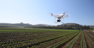
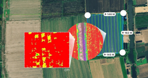
In a similar manner to agricultural-specific NDVI mapping, the solution can be deployed for a myriad of specialised use cases including environmental studies, biomass analysis and coastal studies. The P4M is an all-round solid drone to perform almost any mission.
The only slight downside here to the P4M is the limitation for very large scale missions. Although it can be deployed for large missions, any multirotor platform will struggle given an excessively vast area. It may be the case more often than on ‘regular’ mapping that environmental studies, biomass analysis and coastal studies are large scale areas.
These areas require several spare batteries to be able to complete them resulting in a lot of take-off and landing procedures. Again, this is more than doable but it is worth considering the limitations of not only the P4M but any tool you choose to perform a given task.
If larger missions are a regular occurrence then it may be worth considering a larger multispectral platform with higher-end sensing capability. The biggest improvement would be the increase in coverage area due to the ability to increase the flying height without losing excessive amounts of resolution.
Why choose the Phantom 4 Multispectral?
All in all, Pros & Cons of the Phantom 4 Multispectral indicate that the Phantom 4 Multispectral is a great balance between image quality and accuracy, performance and price. For most, this is the key balance to strike when deciding on any given drone platform.
Survey Drones Ireland are leaders in this field and will continue to be in the coming years. The industry has some exciting times ahead! To join along, get in touch at info@surveydrones.ie for any inquiries, support and sales.
For more information contact one of our experts at Survey Drones Ireland who will be more than willing to assist you in finding what suits your needs.
If you need further advice on this please send an email to info@surveydrones.ie or fill in the contact page on this website.
