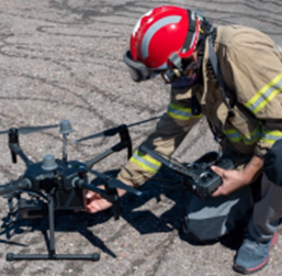
Conducting Public Safety Missions without Geofencing Restrictions
Conducting Public Safety Missions without Geofencing Restrictions
Geofencing was introduced in all DJI products over the course of several years in order to stop casual drone operators drifting into unauthorised airspace. The word describes a virtual fence marked by GPS coordinates. With these coordinates being compared to the drone’s own coordinates, the onboard software could immediately know not to take off and even stop flying forward regardless of the operator’s inputs.
The main goal of Geofencing has always been to stop unauthorised operators from encroaching on controlled airspace. Whether operators would encroach accidentally or intentionally, the result was the same. This raised questions about the safety of such drones. One level of safety control over this, not so small, issue has been continually updated Geofencing technology. First introduced in 2013 with ‘No Fly Zones’ DJI has continually led the way in improving Geofencing through regular updates of firmware to all of its products.
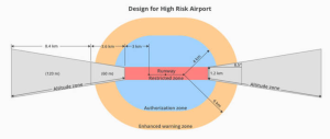
In the vast majority of cases, this has increased the safety of drone operations worldwide and has been a much needed development in building trust with aviation authorities. Public safety missions and other specific commercial operations are the main outliers in an otherwise excellent roll out of this technology.
Public Safety Missions & Geofencing
Public safety agencies such as Law enforcement, Fire services and the Coast guard can all benefit from drone operations. We have seen more and more of such agencies introduce drones into their workflows to great effect.
Currently, DJI has two methods of unlocking restricted airspace. The first, called Flysafe, is available to all operators on DJI’s website with only licensed and authority-approved flights having access to sensitive areas. The second called, ‘The Qualified Entities Program’ is only available to government and public safety agencies.
FlySafe
The flysafe system is available for all drone operators and exists to maximise the safety of drone operations around sensitive areas such as airports, prisons and even stadiums. It is a very simple system in which operators click on a restricted area, give their details and proposed flight times. In return access to that area is received, once approved.
Approval can be nearly immediate or take longer depending on the sensitivity of the airspace. For areas of high sensitivity such as prisons, further proof of local authority approval will be required, in other words written approval from law enforcement, the prison and the governing aviation authority.
Flysafe is a fantastic system for safe hobbyist and commercial operations however, you can clearly see how this may be of hindrance for public safety agencies which may require immediate operation permissions in a restricted area, without delay. This is where The Qualified Entities Program comes in.
The Qualified Entities Program
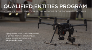
Currently available in Europe, United States and Canada the Qualified Entities Program allows both public safety agencies and government bodies to unlock restricted, geofenced airspace for extended periods of time. The key difference between this and Flysafe is the extended time allowed once approved. DJI states that “Government and Public Safety Entities e.g. Fire Service, Search and Rescue, Coast Guard, Civil Defense, Law Enforcement, Border Control, etc.” can get approval.
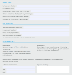
The European Qualified Entities Program Application Form, shown here, indicates the information and requirements each organisation must provide to be approved. Once approved, the verified organisation will be given a minimum of five years access to unlocked altitude and geofencing restrictions.
Conducting Public Safety Missions without Geofencing Restrictions – Geofencing & Controlled Access to Airspace
The most important aspect of any endeavour within aviation is safety. Although you may hesitate to include drones under the aviation umbrella, they are most definitely. Due to the potential severity that accidents can cause, most aviation authorities around the world have strict standards and tight acceptable allowances for anything safety related.
In recent years, drones have become ubiquitous. We have seen more of everything from dangerous close calls at airports to flights over crowded stadiums. In the former, putting airliners at risk and in the latter postponing sporting events for many thousands. This is not the purpose of drones by any means.
Since 2013, DJI has been one of the leaders in the industry regarding controlled airspace restrictions, in turn increasing safety and decreasing disturbances to the public. That being said, government and public safety agencies are now adopting drones into their workflows more and more.
The Qualified Entities Program allows pre-verified agencies full access for at least five years to areas in which the general hobbyist and commercial operator would require daily access or may not even be able to access at all.
Survey Drones Ireland, is Ireland’s only DJI Enterprise Official Silver Partner. For more information, contact one of our experts at Survey Drones Ireland who will be more than willing to assist you in finding what suits your needs.
If you need further advice on this please send us an email to info@surveydrones.ie or fill in the contact page on this website.
