Creating Maps and Models for Emergency Response
Creating Maps and Models for Emergency Response – Mapping and modelling have had a marked impact on how we visualise, plan and operate in emergency responses. Drone mapping and modelling can benefit emergency response at all stages. Planning for future events, responding to immediate emergencies and even reacting to past emergencies or disasters are all areas in which drone outputs can add value. Having the knowledge of the benefits is one thing, successfully acquiring the data on site and using it effectively is a different challenge completely.
Maps
Orthophotos are an extremely useful tool in planning emergency responses. From an evacuation plan at a music festival to post-accident analysis they offer a high resolution aerial view of areas large and small. When combined with GIS datasets such as roads and population density, orthophotos can provide huge value in large-scale emergency planning and response.
Models
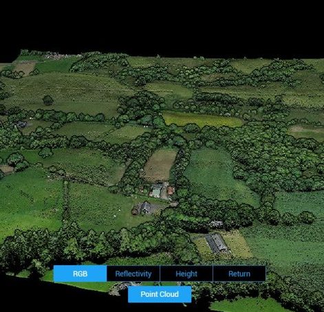
Models can be even more useful compared to orthophotos in that they contain elevation data with a wealth of information such as contours, digital elevation data and 3D visualisation. They are often most useful in disaster, accident and even crime scene investigation after the immediate emergency has passed. Modelling provides a realistic reconstruction of any scene which provides responders with much more depth and spatial awareness compared to images alone.
Making the Maps and Models
Both maps and models can provide extensive and quality datasets for wide ranges of emergency response. The question remains, how do we actually make these maps and models using commercial drones?
Sensor Requirements
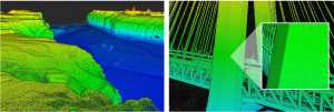
When mapping and modelling with drones the two methods of data collection are photogrammetry and lidar. The most common method of mapping and modelling is image-based photogrammetry however, lidar-based data has its benefits when modelling. Lidar allows for both greater vegetation filtering and night time operations.
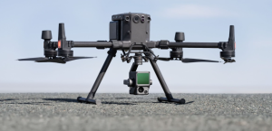
The main downside to lidar-only sensors is that RGB orthophotos are not possible. That being said, sensors such as the DJI Zenmuse L1 provide both lidar and RGB capability in one unit. The L1 could be the perfect solution if both high resolution orthophotos and lidar based models are required.
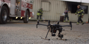
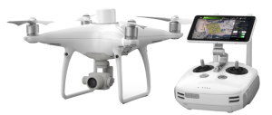
Drone solutions such as the Phantom and Mavic series are very popular for image-based mapping and modelling for a myriad of industries, one of which is emergency response. The familiarity and plug n’ play feel to these platforms often makes it the go to choice for public safety operations. Moreover, these compact drones have had fantastic additions to them in the last couple of years with thermal and zoom capability available from such a small package.
Mission Requirements
The fundamentals of both photogrammetric and lidar based surveys are much the same with some subtle distinctions. Flying height, overlap and sensor settings are the three most important considerations when performing any mapping or modelling mission.
Height
Flying height affects the resolution of each image. What this means in effect is that higher you fly, the faster the job is complete however, you must sacrifice resolution. In much the same way, the higher you fly the further point separation you will see with Lidar data. In both cases the flying height is proportional to the ‘resolution’ of the dataset. As a consequence you must tailor your flying height for what you want to achieve.
In forming an evacuation plan, fire fighting plan or response plan for law enforcement at a large music festival lower resolutions may be perfectly sufficient. However, for post-accident analysis on a road or at a crime scene, higher resolutions may be required to show key details about the scene. The organisation must determine the requirements for its own operations and decide what is best.
Overlap and Point Spacing
Image-based modelling requires good image overlap, at a minimum 70% to 80%. Both vertical (nadir) and oblique imagery are absolutely essential for 3D reconstruction. For Lidar surveys it is critical to pay attention to the point spacing specification of the sensor as well as the flight speed. Both factors directly impact the spacing and therefore density of the resulting pointcloud. Often the aim of modelling is to provide software with a clean, dense point cloud for subsequent output of triangulated meshes and ideally photo-realistic textured meshes. In other words a real representation of the scene in a virtual space.
When producing an orthophoto for mapping, an image overlap of at least 70% must be achieved in a nadir configuration. Lower overlap will quickly introduce empty patches into the orthophoto which is extremely important to avoid no matter the mission let alone one enhancing public safety.
No matter the goal, it is essential to understand the mission at hand to achieve best results during data acquisition and software processing.
Software Requirements
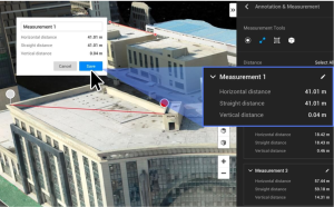
Whether it is lidar based modelling or photogrammetric based orthophotos you will require a good software package to extract the information required for emergency response. Cropping, filtering, masking, taking measurements, export formats and 3D visualisation are often all requirements in adding value to emergency planning, analysis and response. Amongst these value added components of drone data, the most important consideration is that of accurate measurement taking.
Measurements
If measurements are required from the orthophoto or model, control may be required. Uncontrolled GPS will only be accurate to +/- 3m which may suffice for large scale GIS level mapping however, it is often the case that higher levels of accuracy are required. Measuring access and egress areas, evacuation points, extents of damage are all good examples of why measurements may be required. For higher levels of accuracy control is required.
In a rapid response situation ground control will take plenty of valuable time away. This is why using RTK drones such as the Phantom RTK and Matrice RTK systems can be so powerful. They can provide millimetre accuracy with no control. This level of accuracy may not be required for large scale operations in planning and potential repsoning. That being said, when close details matter such as accident and crime scene response this accuracy may very well be a minimum.
Added Value Data for Emergency Response
Mapping and modelling using drones can add a wealth and depth of information and understanding for emergency response. As discussed, understanding your mission case is critical in performing the correct flight plan and configuration. The fundamentals of sensor types, heights, overlap and point spacing are critical to achieve the desired outcome and outputs. Such outputs can then be used to visually inspect and measurement from to best assist in emergency planning, analysis and response.
Creating Maps and Models for Emergency Response can present itself with a number of challenges for which Survey Drones Ireland can best advice on. Survey Drones Ireland, is Ireland’s only DJI Enterprise Official Silver Partner. For more information, contact one of our experts at Survey Drones Ireland who will be more than willing to assist you in finding what suits your needs.
If you need further advice on this please send us an email to info@surveydrones.ie or fill in the contact page on this website.
