Mapping with DJI Drones from Entry Level to Expert
Mapping with DJI Drones from Entry Level to Expert – From entry level consumer drones to enterprise drones and software, DJI has the most diverse range of platforms for all types of mapping. Every drone produced by DJI has the ability to acquire at least some level of photogrammetric mapping data. However as you can imagine, not all are built with the same purpose in mind. Some are more aimed at portability and filming than mapping.
In some sense ‘entry level’ does a disservice to the lower cost drones in the DJI consumer suite. That being said, the enterprise level does offer the extra performance quite often desired by professionals. Here we will take a look at some of the latest DJI drones in each series that offer the strongest mapping performance at each level of operations.
The three most important factors in any kind of drone mapping are the sensor, image positioning accuracy and battery life. Although image positioning accuracy is not as critical as sensor quality, it removes much of the need for ground control when mapping and modelling with drones. Whether it is a larger GIS dataset with lower tolerances or a high accuracy building survey, onboard Real-Time Kinematic positioning is a valuable addition.
The Mini Series
The Mini series are the lowest cost and most entry level drones offered by DJI. The family friendly Mini 2 comes in at a cost of approximately €500 and weighs just 249g. Although the cost price may be attractive at first, sacrifices are made that would result in more limited mapping options. For those looking to dip their toes into aerial mapping as a hobby or even to upskill with little upfront cost, the Mini series could be an ideal starting point.
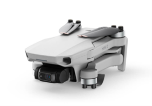
Key Specs for Mapping
Sensor: 1/2.3” CMOS & 12 MP
Wind Resistance: 8.5-10.5m/s
Max Flight Time (Ideal conditions): 31 mins
Image Positioning Accuracy: Standard GNSS (+/-3m)
Mapping Pros
- Low cost and low risk for entry level operators.
- Very compact to carry anywhere.
- Good battery life.
Mapping Cons
- Smaller sensor at a size of 1/2.3 inches.
- No alternative sensor options such as thermal and lidar.
- No RTK positioning available.
- Lower wind resistance at 8.5-10.5m/s, moderate winds may stop mapping missions.
- External devices such as a phone or a tablet are required to operate.
The Mavic Air Series
Sitting between the Mini and Mavic series, the Mavic Air is still a good entry level drone into the world of mapping. At a price point of about €850 it is slightly more expensive than the Mini with slightly more capability to be found. In strict mapping terms the only real improvement over the Mini is the small increase in the size of the sensor.
You will notice very little difference between the key specs as well as the pros and cons between both drones. The difference is even more negligible considering the May 2022 release of the Mini 3 Pro that sits at the same price point as the Mavic Air 2.
Outside of this the Air series has more shooting modes and slightly more performance compared to the Mini however, they are not of any real priority for mapping. If the drone will be used for filming, taking aesthetic images alongside mapping than the upgrade from the Mini to Air is worth real consideration.
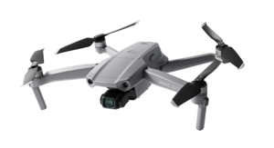
Key Specs for Mapping
Sensor: 1/2” CMOS & 48 MP
Wind Resistance: 8.5-10.5m/s
Max Flight Time (Ideal conditions): 34 mins
Image Positioning Accuracy: Standard GNSS (+/-3m)
Mapping Pros
- Lower cost and lower risk for entry level operators.
- Very compact to carry anywhere.
- Good battery life.
Mapping Cons
- Smaller sensor at a size of 1/2 inch.
- No alternative sensor options such as thermal and lidar.
- No RTK positioning available.
- Lower wind resistance at 8.5-10.5m/s, moderate winds may stop mapping missions.
- External devices such as a phone or tablet are required to operate.
The Mavic Series
The Mavic series was DJI’s first step away from the rigid fuselage design of the Phantom into the world of sleek foldable hardware. Since its introduction the series has seen incredible incremental advancements in its sensors and overall capability.
The latest generation, Mavic 3 offers an impressive 4/3 inch sensor targeted at higher-end cine filming. Although this bodes well for mapping, here we will take a look at the Mavic 2, in particular the enterprise edition which sits at an approximate price point of €3,500. This platform is a good option given the portability and positioning capability with both sensor and RTK options.
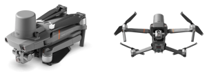
Key Specs for Mapping (Mavic 2 Enterprise)
Dual Sensor Configuration: 1/2 Inch Sensor & Thermal (640 X 512)
Wind Resistance: 10m/s
Max Flight Time (RTK Attached): 28 mins
Image Positioning Accuracy: Standard GNSS (+/-3m) or RTK GNSS (+/-50mm)
Mapping Pros
- RTK positioning available.
- Dual sensors.
Mapping Cons
- Bump up in initial cost.
- Still a smaller sensor than the Phantom 4 and Mavic 3.
- Slightly lower battery life with the RTK module attached.
Mapping with DJI Drones from Entry Level to Expert – The Phantom Series
Anyone familiar with DJI is familiar with the Phantom. Phantom 1 was the company’s first commercial drone released back in 2013 and the series has seen 3 major iterations in the last decade. The current phantoms are the 4 Pro and 4 RTK. Both solutions are two of the strongest options for overall capability and image quality given the price points.

Key Specs for Mapping
Sensor: 1” CMOS & 20 MP
Wind Resistance: 10m/s
Max Flight Time (Ideal conditions): 30 mins
Image Positioning Accuracy: Standard GNSS (+/-3m) or +/-50mm RTK
Mapping Pros
- The Phantom 4 pro is offered at a very reasonable price.
- The 1 inch sensor results in higher image quality compared to the smaller Mini and Air series.
- The phantom 4 RTK offers very high accuracy image positioning, ideal for mapping particularly on large sites.
- Good battery life.
- The Phantom 4 can be fitted with multispectral and thermal cameras however the setup is more cumbersome than the integrated platforms such as Matrice and Mavic.
- Solid wind resistance at 10m/s, strong gusts may stop mapping missions.
Mapping Cons
- For the highest-end professional mapping, a larger sensor size and specific lens is always good, that being said the 1 inch sensor is sufficient for most operations.
- The phantom cannot operate dual cameras seen in the Mavic series.
- There is no option to fit thermal or lidar sensors.
- The RTK unit is embedded in the fuselage giving a sleek design but without the modular freedom seen on the Mavic 2 Enterprise.
Mapping with DJI Drones from Entry Level to Expert – The Inspire Series
The Inspire series is possibly the single series most targeted at film makers and high-end photography. Inspire 1 was the first filmmaking drone in the world to integrate a HD video transmission system and 360 degree rotating gimbal. The Inspire 2 improves on this and with higher performance including speeds of up to 94km/h and staggering acceleration. The most impressive element of the drone is its ability to comfortably carry Zenmuse sensors such as the X7 as a payload while maintaining good battery life.
As impressive as that is, the Inspire series is maybe not the choice for mapping specific missions. Although it is more than capable of carrying out high-end photogrammetric and potentially even lidar surveys, much of its price is invested in high-performance film making tasks. At a price point of about €10,000 with the Zenmuse X7 payload, it may take some convincing for mapping specific tasks given the lack of integration for PPK or RTK units.
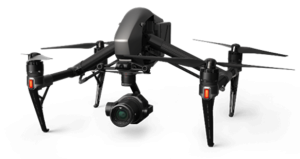
Key Specs for Mapping
Sensor: 4/3 inch & 24 MP Stills
Wind Resistance: 10m/s
Max Flight Time (Zenmuse X7): 23 mins
Image Positioning Accuracy: Standard GNSS (+/-3m) or +/-50mm RTK
Mapping Pros
- Very High quality sensor options such as the Zenmuse X7 & X4S.
- Good wind resistance.
Mapping Cons
- Lower battery life at 23mins with the Zenmuse X7 mounted.
- High upfront cost with filming making specific design rather than mapping specific design.
- RTK may be retro-mounted however, it is less than ideal compared to the alternative more modern designs of the Mavic 2 Enterprise, Phantom 4 RTK and Matrice.
Mapping with DJI Drones from Entry Level to Expert – The Matrice Series
The Matrice series is the company’s flagship industrial drone platform. Specifically designed for mapping and inspection with durability in mind and a myriad of sensor selections available. The early versions of Matrice, most notably the M600 were more so designed for heavy duty filmmaking but the series has found a home with industrial use. The latest M300 and M30 have seen the series slimmed down greatly with sleek and integrated multi-sensor options.

Key Specs for Mapping
Sensors: DJI Zenmuse suite including third party options.
Wind Resistance: 15m/s
Battery Life (Ideal conditions): 31 mins
Positioning: Standard GNSS (+/-3m) or +/-50mm RTK
Mapping Pros
- Large selection of sensor options including thermal, lidar, RBG and multispectral.
- Long battery life of up to 55 mins with the M300.
- The highest quality sensors for impressive data results.
- RTK positioning.
- Strong wind resistance at 15m/s.
Mapping Cons
- Higher up front cost and additional cost for extra sensors.
- Potentially large datasets making processing cumbersome without sufficient computing power.
Mapping with DJI
DJI has the best selection of multirotor drones for mapping on the market today. From the entry level Mini series to the professional Matrice-Zenmuse sensor combination, each platform is capable of photogrammetric mapping. As you go up the ladder of drones, more options become available beyond just photogrammetry and standard GNSS image positioning. At the highest end DJI offers the Matrice series giving incredible functionality and flexibility for photogrammetric, lidar and multispectral mapping.
Mapping can present itself with a lot of challenges, Whatever the level, see how Survey Drones Ireland can help you to get the right drone for your mapping operations.Survey Drones Ireland, is Ireland’s only DJI Enterprise Official Silver Partner.
For more information, contact one of our experts at Survey Drones Ireland who will be more than willing to assist you in finding what suits your needs.
If you need further advice on this please send us an email to info@surveydrones.ie or fill in the contact page on this website.
