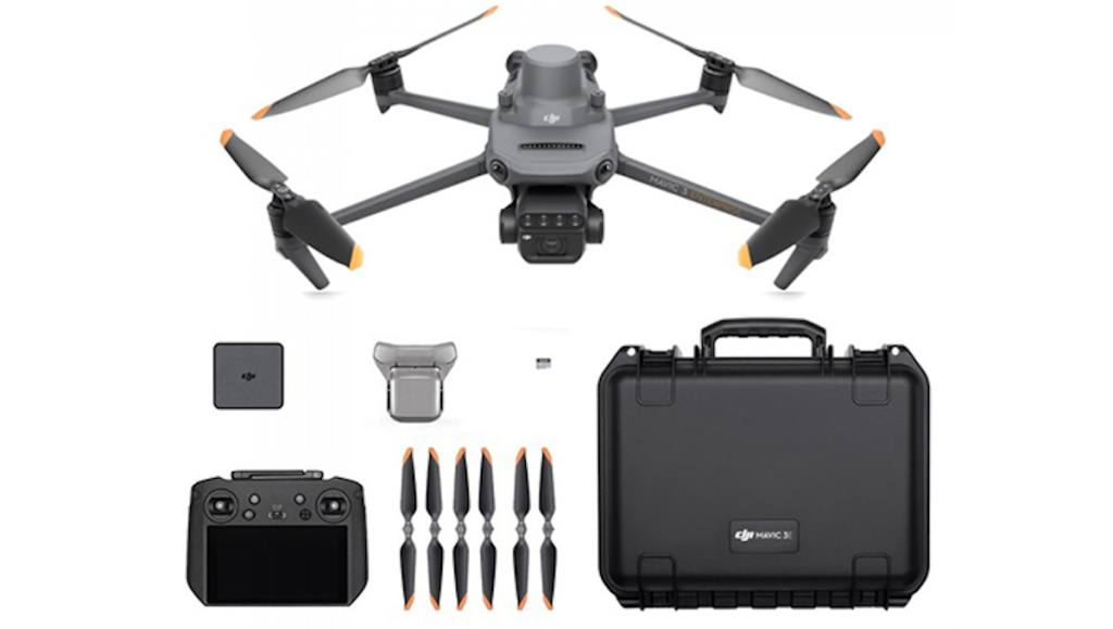
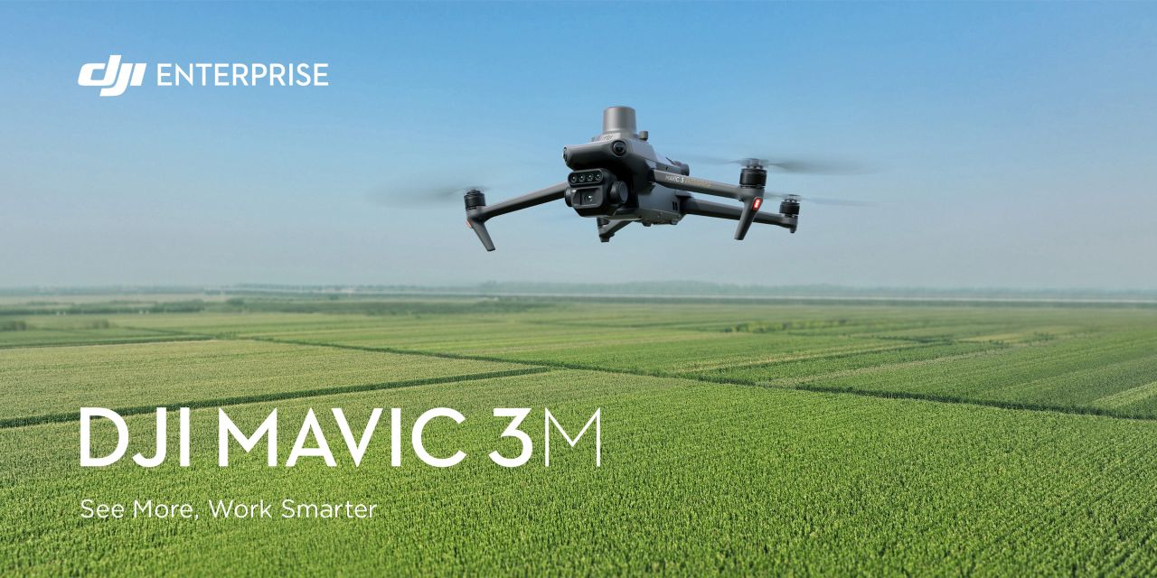
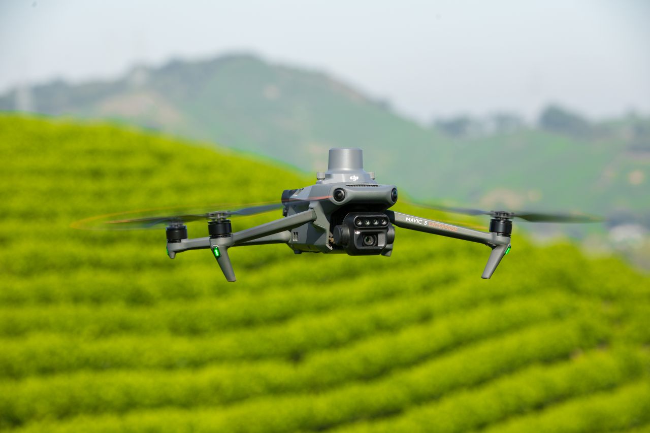
DJI Mavic 3 Multispectral
Mavic 3 Multispectral – €3727.64 Less VAT
1 X Mavic 3 Multispectral
1 X Battery Kit.
(RTK Module and Light Sensor included)
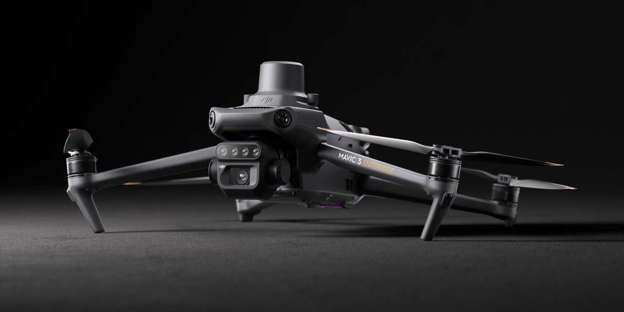
DJI Mavic 3 Multispectral
Precision Agriculture & Environmental Mapping Drone
The DJI Mavic 3 Multispectral is a compact, enterprise-grade drone designed for precision agriculture, land management, and environmental monitoring. By combining a high-resolution RGB camera with an integrated multispectral sensor array, it enables accurate crop analysis and data-driven decision-making from a single flight.
Built for efficiency and reliability, the Mavic 3 Multispectral delivers actionable insights while reducing time in the field, making it an ideal solution for agricultural professionals and land managers.
Key Capabilities
Integrated Multispectral Imaging
- Four-band multispectral sensor capturing Green, Red, Red Edge, and Near Infrared
- Enables vegetation indices such as NDVI, NDRE, and GNDVI
- Supports early detection of crop stress, disease, and nutrient variability
High-Resolution RGB Mapping
- 20 MP 4/3″ CMOS RGB camera optimised for photogrammetry
- Produces detailed orthomosaics and visual reference imagery
- Ideal for field mapping, land surveys, and environmental assessments
RTK-Enabled Accuracy
- Integrated RTK positioning for centimetre-level accuracy
- Minimises the need for ground control points
- Delivers consistent, repeatable data suitable for professional workflows
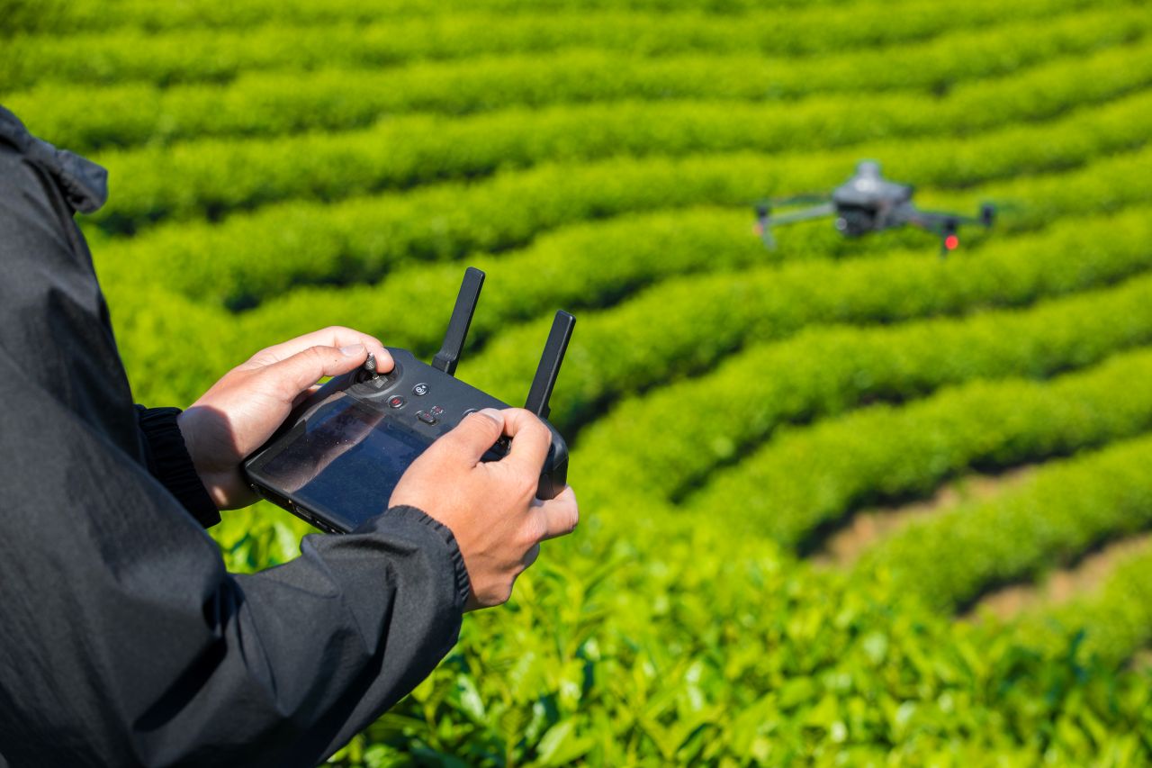
Efficient Field Operations
- Long flight endurance enables coverage of large areas in a single mission
- Automated mission planning ensures consistent overlap and data quality
- Compact, foldable design supports rapid deployment and single operator use
Advanced Safety & Flight Intelligence
- Omnidirectional obstacle sensing enhances operational safety
- Stable flight performance in variable conditions
- Intelligent failsafe systems support regulated operations
Designed for Professional Use
The DJI Mavic 3 Multispectral is engineered to meet the needs of modern precision agriculture and environmental monitoring in Ireland, offering a balance of accuracy, efficiency, and ease of use. Its integrated sensor suite and intelligent flight systems make it a powerful tool for improving productivity and supporting sustainable land management practices.
Typical Applications
- Precision agriculture and crop monitoring
- Vegetation health and stress analysis
- Environmental and land-use mapping
- Forestry and habitat assessment
- Research and agricultural consultancy
For More Info Contact Us!
DJI Mavic 3 Multispectral — Technical Specifications
Aircraft & Performance
- Aircraft Weight (with propellers & RTK module): ~951g
- Max Take-off Weight: ~1,050g
- Dimensions (Folded): 223 × 96.3 × 122.2 mm
- Dimensions (Unfolded): 347.5 × 283 × 139.6 mm
- Diagonal Wheelbase: 380.1 mm
- Max Flight Time (No Wind): ~43 min
- Max Hover Time (No Wind): ~37 min
- Max Flight Distance: ~32 km
- Max Speed (Normal Mode): 15 m/s
- Max Wind Resistance: 12 m/s
- Max Take-off Altitude: 6,000 m above sea level
- Operating Temperature: -10 °C to 40 °C
Navigation & Positioning
- GNSS: GPS + Galileo + BeiDou + GLONASS (GLONASS only with RTK module enabled)
- Hover Accuracy:
- Vertical: ±0.1 m (Vision/RTK)
- Horizontal: ±0.1 m (RTK)
RGB Camera (Photogrammetry)
- Sensor: 4/3″ CMOS, 20 MP effective pixels
- Lens FOV: 84° (Equivalent 24 mm)
- Aperture: f/2.8–f/11
- Shutter: Electronic & Mechanical
- Photo Formats: JPEG / DNG (RAW)
- Video: 4K @ 30 fps / FHD @ 30 fps
Multispectral Camera
- Sensor: 1/2.8″ CMOS, 5 MP per band
- Bands:
- Green (G): 560 ± 16 nm
- Red (R): 650 ± 16 nm
- Red Edge (RE): 730 ± 16 nm
- Near Infrared (NIR): 860 ± 26 nm
- Lens FOV (Multispectral): ~73.91°
- Image Size: 2592 × 1944
- Photo Output: TIFF, NDVI/GNDVI/NDRE content
Gimbal & Stabilisation
- Gimbal: 3-axis mechanical (tilt, roll, pan)
- Stabilisation: Precision mechanical stabilization for smooth, consistent imaging
Sensing & Obstacle Avoidance
- Omnidirectional Vision Sensors: Front, back, left, right, up and down detection
- Effective Ranges: Upwards to ~10 m; sideways and forward up to ~25 m depending on direction, with obstacle avoidance at speeds up to 15 m/s
Transmission & Connectivity
- Video Transmission System: DJI O3 Image Transmission Industry Edition
- Live View Quality: 1080p/30 fps
- Max Signal Distance (Unobstructed):
- CE: ~8 km
Battery &amp; Power</span>
- Battery: 5000 mAh Lithium-ion
- Charging Time: ~3 hours