DJI Zenmuse L3


DJI Zenmuse L3
Advanced Aerial LiDAR Mapping Sensor
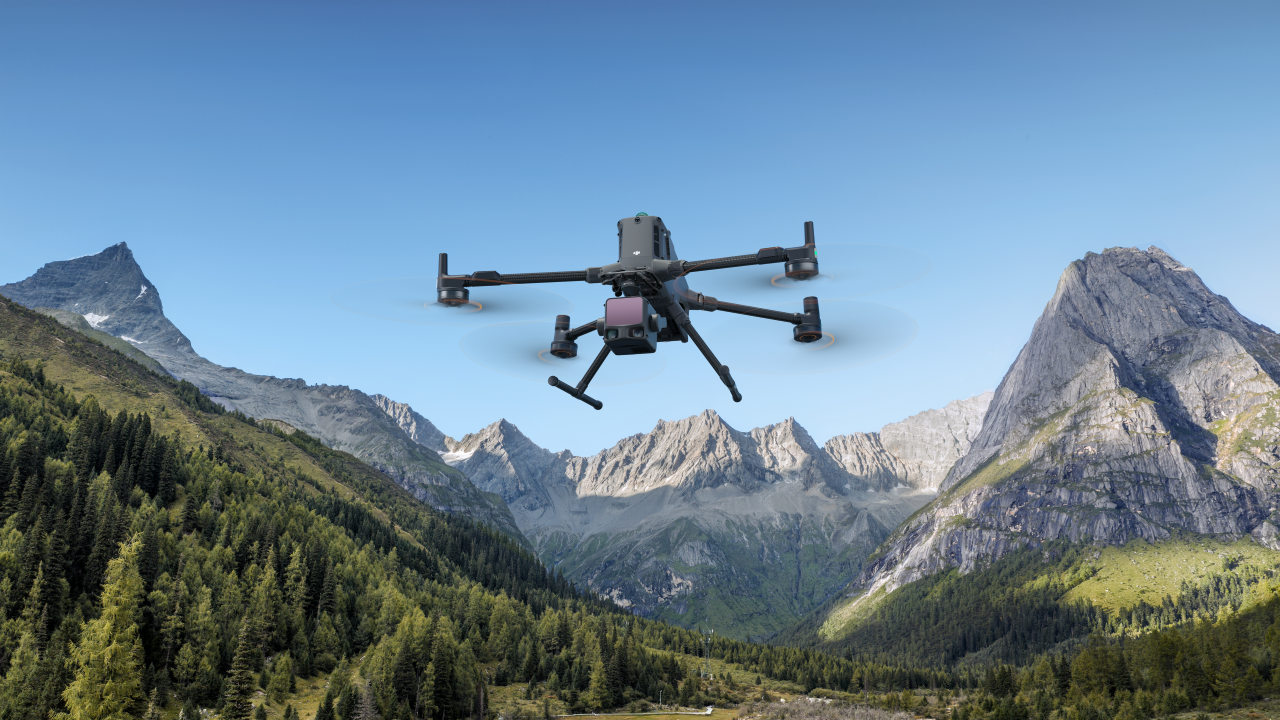
The DJI Zenmuse L3 is a next-generation aerial LiDAR sensor designed for high-accuracy 3D mapping, terrain modelling, and vegetation analysis. Engineered for demanding professional operations, the L3 delivers reliable point cloud data with exceptional efficiency, even in complex and vegetated environments.
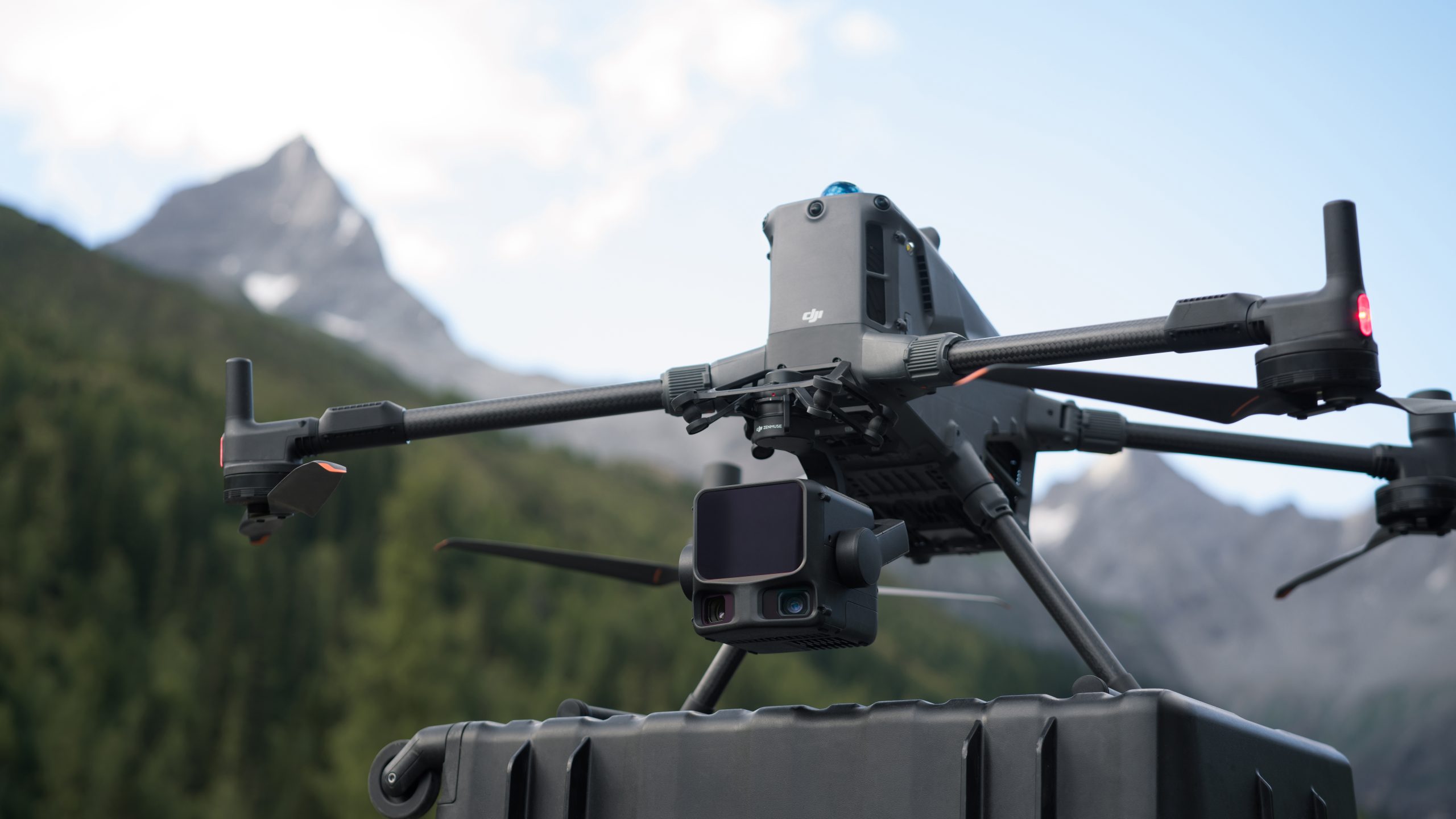
By combining high-performance LiDAR with an integrated RGB camera and precise positioning, the Zenmuse L3 enables accurate data capture for surveying, infrastructure, and environmental applications.
Key Capabilities
High-Accuracy LiDAR Mapping
- Delivers dense, accurate point clouds for detailed terrain and asset modelling
- Penetrates vegetation to capture ground elevation beneath canopy
- Ideal for topographic surveys, corridor mapping, and environmental analysis
Integrated RGB Imaging
- Built-in RGB camera provides colourised point clouds and visual reference imagery
- Supports improved interpretation and classification of LiDAR data
- Enhances mapping deliverables and reporting outputs
Efficient Large-Area Coverage
- High pulse repetition and wide scan coverage reduce flight time
- Enables large-area mapping with fewer missions
- Improves operational efficiency and project turnaround times
Precision Positioning
- Integrated IMU and RTK support when paired with compatible DJI aircraft
- Accurate georeferencing for professional LiDAR workflows
- Reduces reliance on extensive ground control networks
Optimised for Enterprise Platforms
- Designed for seamless integration with DJI enterprise aircraft
- Supports automated mission planning and repeatable survey workflows
- Built to meet the needs of regulated and mission-critical operations
Designed for Professional Surveying & Mapping
The DJI Zenmuse L3 is purpose-built for organisations that require reliable, high-quality 3D spatial data. Its combination of LiDAR performance, RGB context, and operational efficiency makes it a powerful solution for surveyors, engineers, utilities, and environmental professionals working across a wide range of challenging environments.
Typical Applications
- Topographic and terrain surveying
- Forestry and vegetation analysis
- Corridor and linear infrastructure mapping
- Powerline and utility inspections
- Environmental and flood modelling
For More Info Contact Us!
DJI Zenmuse L3 — Technical Specifications
General
- Sensor Type: Long-range aerial LiDAR system with integrated RGB imaging
- Compatible Aircraft: DJI Matrice 400 series only (requires the Zenmuse L3 single gimbal connector)
- Mount: DJI SkyPort (single gimbal connector)
- Dimensions (L×W×H): ~192 × 162 × 202 mm
- Weight: ~1.60 kg (approx.)
- Environmental Protection: IP54 (without single gimbal connector)
LiDAR System
- Laser Wavelength: 1535 nm long-range LiDAR
- Max Detection Range: Up to ~950 m @ 10% reflectivity (100 klx ambient light)
- Pulse Frequency: Adjustable (up to ~2 MHz for density/penetration flexibility)
- Returns per Pulse: Up to 16 returns (multi-return capability)
- Scan Patterns: Linear, Star-Shaped, Non-Repetitive (mission-optimised scanning)
- Survey Efficiency: Up to ~10 km² per mission; ~100 km² per day (typical enterprise workflows)
RGB Mapping Cameras
- Camera Type: Dual RGB mapping cameras (integrated)
- Effective Pixels: 100 MP each (Micro Four Thirds sensor)
- Image Use: Colourised point clouds, orthophotos, photogrammetric context imagery
- Field of View: ~107° horizontal (combined imaging coverage)
Positioning & Accuracy
- High-Precision POS (Position & Orientation System): Yes — IMU + time-synchronisation for geospatial precision
- Survey Accuracy:
- Vertical and horizontal accuracy varies by altitude and workflow (survey-grade performance)
Data & Workflow
- Data Storage: CFexpress Type B memory card (high-speed)
- Software Ecosystem:
- DJI Pilot 2 (data collection)
- DJI Terra / DJI Modify (data processing and point cloud outputs)
- DJI FlightHub 2 (enterprise management)
- Output Formats: Standard point cloud formats (LAS/LAZ/PLY/PCD/etc.) plus orthophotos and derived deliverables
Operating Environment
- Operating Temperature: -20° to 50° C (-4° to 122° F)
- Storage Temperature: -40° to 70° C (-40° to 158° F)
