PIX4Dcloud/Advance

Capture

Process
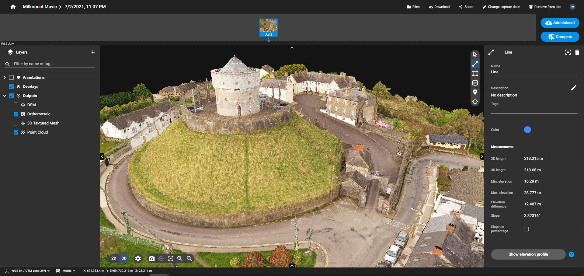
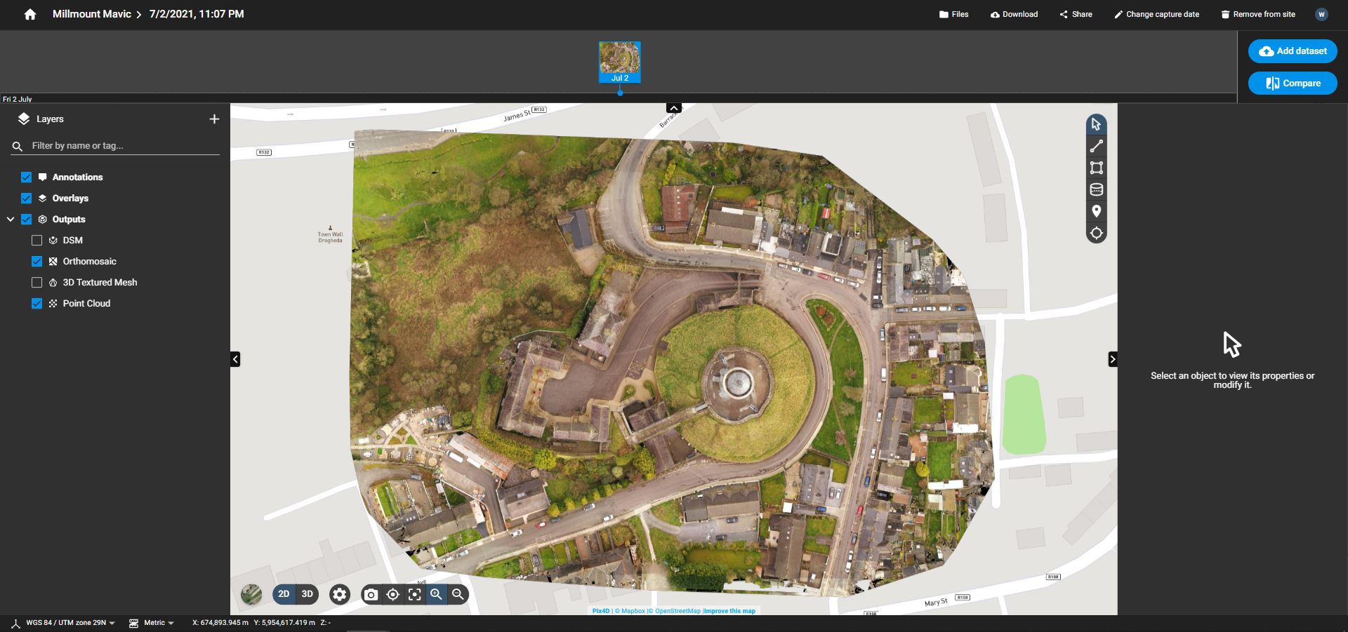
Generate accurate and georeferenced orthomosaics, 3D meshes, point clouds, and elevation models.
Analyze

Share
Product Information
PIX4Dcloud
- Create accurate 2D maps and 3D models from images
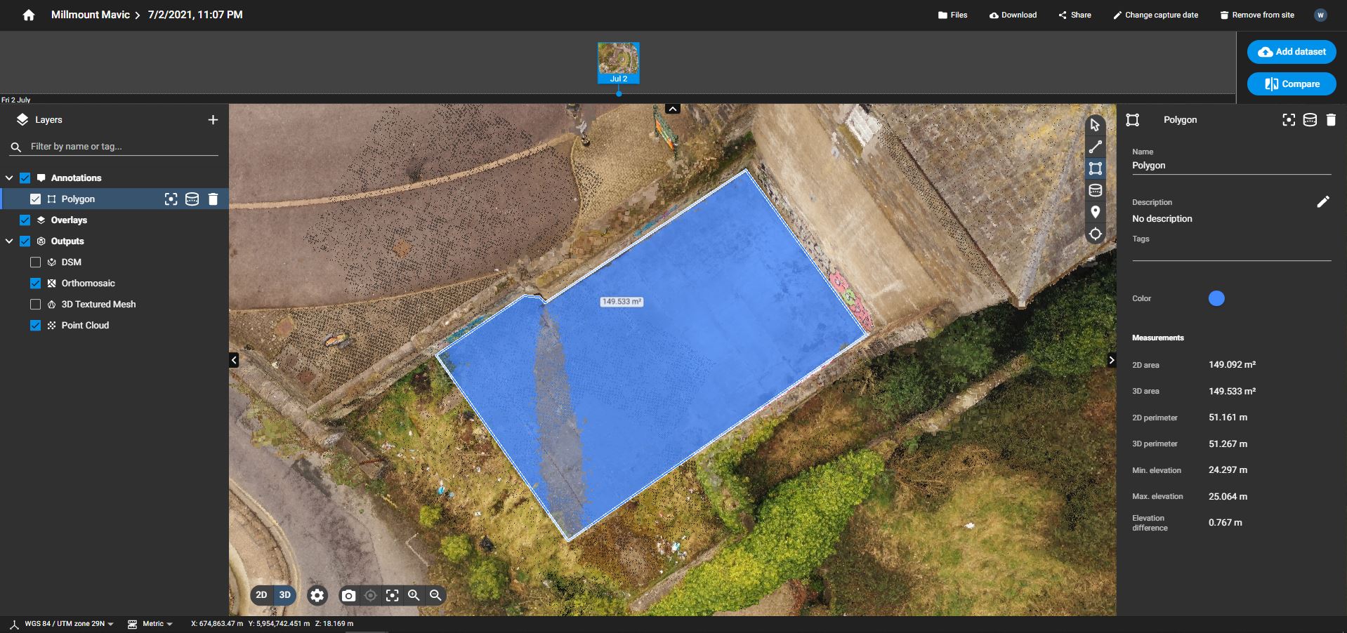
- Measure distances, areas, and volumes
- Add annotations
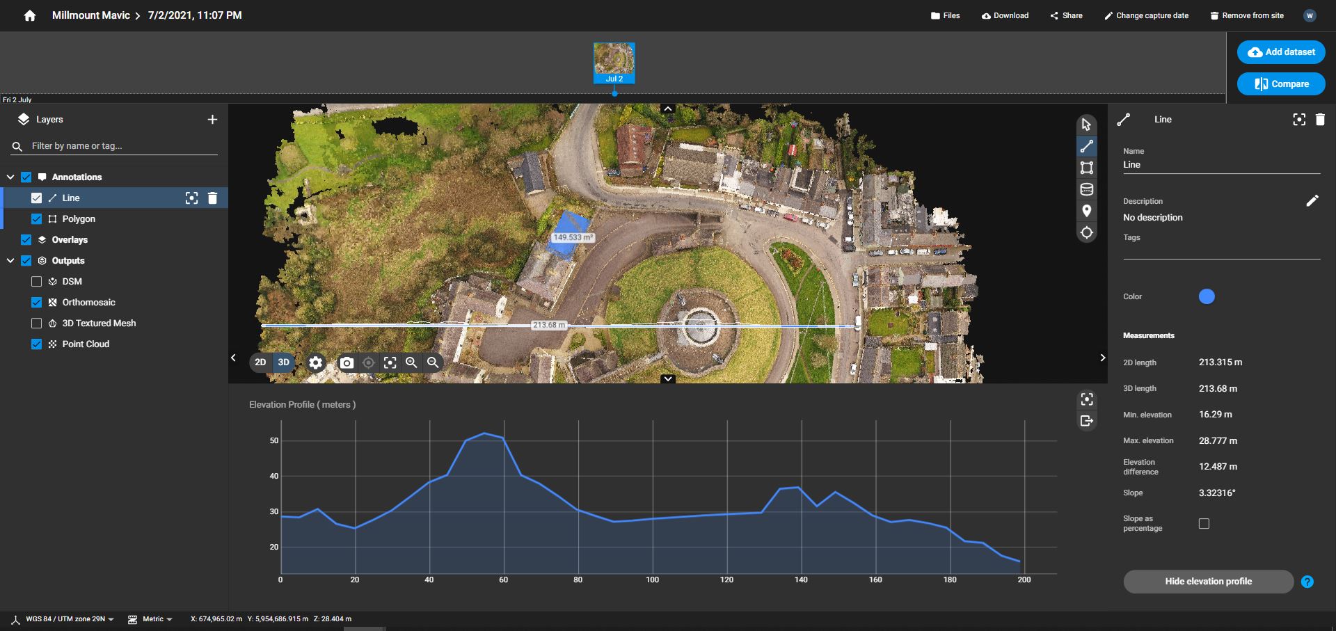
- Generate elevation profiles
- Perform virtual inspections
- Share with team and stakeholders
PIX4Dcloud Advanced
All PIX4Dcloud features, plus:
- Track and document site progress with visual Timeline
- Increase accuracy with AutoGCPs
- Compare volumes over time
- Overlay design plans and maps
- Compare two image maps to see what has changed
Full Features of both products.
PIX4Dcloud and PIX4DcloudAdvance are a web base software. You can either upload for Cloud Processing or upload Processed Datasets that you have process on your Desktop Licence .
PIX4DcloudAdvance can accommodate Ground Control Points. However these Ground Control Points have to be of a certain type. See images of Example GCP’s.
If the average GSD of the projects is 2.5 cm (1 inch), the recommended target size is 50 cm (20 inch).
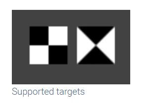
Black and white targets are supported. Other colors may work in some circumstances.
FAQ.
Regarding Pix4Dcloud data security 1, this is what we currently offer:
- end to end encryption (HTTPS) during transport.
- Encryption at rest in S3 (using AWS service, meaning AWS has the key).
- optional “confidential” on the account which means that Pix4D employees get no access to the data (except for a few admins). This is an option that you can ask me to enable for your projects.
- GDPR compliant processes (see this post 1).
Pix4Dcloud sharing links can be activated or deactivated but cannot be protected by a password at the moment.
You can also define your data privacy preferences from the Privacy section of your Pix4D account.
- When you agree to share personalized analytics and diagnostics to help Pix4D improve your experience Pix4D may analyze your use of our products in order to improve the most used features and invest in developing new features. Pix4D may also reach out to you for early feedback regarding your experience.
- When you agree to allow Pix4D algorithms to learn and improve from your project details Pix4D may improve its algorithms by using your project data as training data for machine learning. These algorithmic improvements speed up the performance and increases the quality of the results our products produce.
PIX4Dmapper enables you to have full control of your project: adding Ground Control Points (GCPs) and Manual Tie Points (MTPs), editing the densified point cloud, and changing many more settings which can improve the final results.
PIX4Dcloud also allows to achieve high-quality results but lets the user choose among a predefined set of processing templates. PIX4Dcloud is the easiest way to share a project online with just a link and to do some simple but practical analysis.
PIX4Dcloud Advanced has all the PIX4Dcloud functionalities but also allows the user to group and visualize site projects in a timeline, add control points without any need to mark them, add design maps and plans, compare two days and perform volume comparisons. here are other features of PIX4D Cloud Advance has over PIX4D Cloud.
The number of images that can be processed using PIX4Dcloud or PIX4Dcloud Advanced depends on the following as PIX4Dcloud have a credit-based system, the amount of credits will be different depending on the type of Licence.
Pix4D uses a credit-based system to calculate processing costs. The number of credits required for a project depends on:
-
Image Resolution (in Megapixels) – Higher-resolution images contain more data and require more processing resources.
-
Number of Images – The more images you upload, the more credits are consumed.
-
Division by 100 – This is a scaling factor used to standardise credit consumption.
EXAMPLE.
To calculate processing a project with 200 images taken with a 20 MP drone camera would require 40 credits.
Credits = (20 × 200) ÷ 100 = 4,000 ÷ 100 = 40 credits
Pix4D uses a simple and transparent credit system to estimate how many processing credits you’ll need for a dataset. The number of credits required depends on two main factors: the resolution of your images (in megapixels) and the total number of images, then divide by 100.
Should you need more information, simply contact us and discover all your options.
The following browsers are officially supported for PIX4Dcloud on Windows 10+ and MacOS:
- Chrome (latest version)
- Firefox (latest version)
- Microsoft Edge (latest version)
- Safari (latest version)
Note: To display very big results, the 64-bit version of the browser might be required.
As a cloud product, there are no specific requirements in terms of RAM, CPU, GPU for processing and disk space for storing the data. However, ensure that:
- Your GPU driver is updated.
- Your browser is updated.
- You have a good internet connection.
- Your Upload Speed will be a factor when uploading large data to PIX4D Cloud/Advance.
A processing area can be used for processing on PIX4Dcloud if combined with PIX4Dmapper. The processing area should be drawn using PIX4Dmapper beforehand:
1. After installing PIX4Dmapper , create a new project from the images. Alternatively, if the project was previously processed on PIX4Dcloud, it is possible to download the project directly to your Desktop and then imported into PIX4D Mapper.
2. Create a processing area. Process the data, then
3. Upload the project with the processing area from PIX4Dmapper to PIX4Dcloud.
A cluster of servers is assigned to each account for processing and storage. This cluster can be changed in the Account Settings.
Projects are kept on Pix4D servers according to the PIX4Dcloud storage expiration policy.
For more information on the feature availability before and after the license expires, please read: Feature availability – PIX4Dcloud and PIX4Dcloud Advanced.
Trial license:
- A PIX4Dcloud Advanced trial
- A PIX4Dengine Cloud trial
- A PIX4Dmatic/PIX4Dsurvey trial license
- A PIX4Dfields/PIX4Dreact trial license
Paid license:
- A PIX4Dcloud/PIX4Dcloud Advanced rental license/subscription
- A PIX4Dengine Cloud rental license
- A PIX4Dmatic/PIX4Dsurvey/PIX4Dfields/PIX4Dreact perpetual license with a valid Support and Upgrade (S&U)
- PIX4Dmatic/PIX4Dsurvey/PIX4Dfields/PIX4Dreact/PIX4Dmapper rental license/subscription
- PIX4Dmapper perpetual license with valid Support and Upgrade (S&U)
If none of the above licenses are valid, projects are deleted:
- For trials, 30 days after the end of the license validity.
- For all monthly, yearly, and perpetual licenses and subscriptions, 60 days after the end of the license/subscription validity.
Notification emails are sent to inform users:
- 30 days, 7 days, and 1 day before proceeding with the deletion, for all expired monthly, yearly, and perpetual licenses and subscriptions
- 7 days, and 1 day before proceeding with the deletion, for expired trials.
Example: A user creates a project with a PIX4Dcloud Advanced trial and, 20 days after the trial expiration date, the user buys a monthly PIX4Dcloud license: the project will not be removed. However, if the user buys the monthly license after 31 days the trial expired, the project will be deleted and will not be accessible anymore
Free storage limit
As part of our new cloud service offerings, Pix4D has established a Cloud Fair Usage Policy to ensure efficient and equitable resource usage. This policy outlines the storage limits associated with each product license and provides guidelines on actions that will be taken if these limits are exceeded.
-
PIX4Dmatic, PIX4Dsurvey, PIX4Dfields, and PIX4Dreact: 15 GB.
-
PIX4Dcloud Basic: 500 GB.
-
PIX4Dcloud Advanced: 2 TB.
-
PIX4Dcloud Enterprise or Engine Cloud: 10 TB
Pix4D strives to provide sufficient storage for its users. However, if it identifies excessive or unfair storage usage, Pix4D reserves the right to occasionally request certain users to reduce their storage usage.
Warning: The total storage is not the sum of all licenses. For example, a user with a PIX4Dmatic and a PIX4Dcloud standard license can store up to 500 GB.
Please get in touch if you have ay questions in relation to Cloud Storage.


