Using Lidar Data for Public Safety Missions
Using Lidar Data for Public Safety Missions – Law enforcement, search and rescue, fire fighting, accident investigation and natural disaster response are all essential sectors of public safety. In each, drones have already been adopted in various ways to help support ground teams in maximizing the efficacy and efficiency of public safety missions.
Light Detection And Ranging (Lidar) is a remote sensing technique in which light is sent from a sensor into the environment. If this light, which is essentially a small bundle of electromagnetic energy, bounces off an object in the environment it may then be received by the same sensor. This is then calculated at a point in a given 3D space or coordinate system. Many thousands of these points generated each second can rapidly make up a dense point cloud.
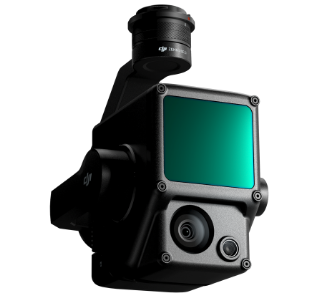
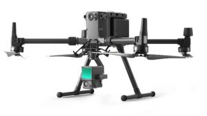
This technology has both aerial and terrestrial applications from the DJI Zenmuse L1 to the Leica Geosystems RTC 360 scanner. Let’s have a look at what aerial-based Lidar platforms can achieve today in public safety.
Fire and Explosion Investigation
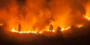
From small apartments to full forests, fires can cause significant damage and can easily threaten life. After a fire has done its damage, investigators must determine the point of origin of the fire, the cause and document the extent of the damage that has been caused to the building or environment.
Drone-based lidar sensors such as the Zenmuse L1 can rapidly cover the external areas of the fire and cover large ground in minutes. Once a mission is complete, investigators have a 3D point cloud from which the scene can be visualized and measured even after the building has been demolished. Traditional manual tape measurements are often an arduous task and depend on weather and the level of safety on-site. The ability to determine window and door dimensions can help determine how the building is ventilated and 3D models can even be used to generate flow models to determine how the fire likely spread.
This is also important for an explosion forensic investigation. After an explosion it is very important to determine the direction and distance objects have traveled after detonation. This is a perfect example of how drone-based lidar such as the Zenmuse L1 can be used to map the area and greatly help investigators. Even the best investigators are likely to have omissions. Although Lidar does not claim to be perfect, it can greatly reduce the likelihood of omissions during investigations.
Accident and Crime Investigation
From fire and explosives to accidents and crime, lidar technology has many of the same benefits across investigations. Taking a motorway collision as an example, drone-based lidar can rapidly gather the entire incident in an accurate 3D point cloud at any time of the day or night.
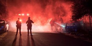
One of the major benefits of lidar over photogrammetric reconstruction of a scene is that lidar is an ‘active’ sensing method. This means that it does not rely on environmental light to acquire a useful dataset. It’s rapid nature means that the data for a full reconstruction can be gathered in very little time to allow law enforcement to clear the incident and deal with oncoming traffic more efficiently.
In a similar fashion, crime scenes can also be reconstructed rapidly with minimal interference of the site. Already terrestrial lidar, more commonly known as laser scanning, is being used to reconstruct crime scenes to greatly help forensic investigators determine the line of events. Drone-based Lidar can be implemented the same way however, it has the added advantage of being able to cover areas at a larger scale.
For this data to be allowed or ‘admissible’ in court, it is not good enough for the operator to just simply know how to fly a drone. They must understand the nature of the data such as its limitations, errors as well as how to verify and ensure accuracy across the dataset. They must be qualified and simply put, know what they are doing.
Search & Rescue
Drones can be extremely helpful in search and rescue missions. Regular RBG sensing and thermal sensing both have great benefits for missions. However, possibly one of the more overlooked areas is how Lidar can be used to help search and rescue crews.
During any type of search time is of critical importance.
Using DJI’s Zenmuse L1 platform, live lidar data can be fed back to the operator and quickly loaded onto software. The rapid transition from arrival on-site to point cloud can help in search missions greatly.
The benefit of airborne Lidar systems is not only how quick they can achieve results but also the significant amount of ground they can cover. However, it is not just about the quantity of ground, Lidar can accurately determine the terrain with the ability to penetrate vegetation. This increases the probability of victims being discovered and allows search crews to best evaluate the path towards them.
Natural Events & Disasters
Drone-based Lidar can help enhance public safety in a range of extreme natural disasters to seemingly benign natural events.
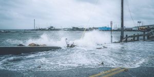
At the extreme, drone-based Lidar can evaluate extensive and large-scale damage in the aftermath of earthquakes, hurricanes, tornados, mudslides and volcanic eruptions. At the other end of this scale there can be ongoing monitoring or even preemptive scanning of natural structures such as caves and rock faces that may be shifting or may be at risk of doing so in the future. This is obviously of critical importance where large populations could be affected. Not just from the risk of loss of life but also potential disruption to infrastructure such as transportation.
In a preemptive context, potential costs to life and financial loss can be determined. This information can then be used to generate an appropriate risk analysis that is evidenced-based, having used the latest technology that the industry can offer.
On the other hand, the same can be carried out post-occurrence. Lidar can be deployed rapidly and accurately to help quickly determine the extent of life lost, financial loss, destruction of infrastructure and much more.
Enhanced Public Safety
Drone-based Lidar is one of the most recent developments in technology that public safety missions can choose to deploy. Using the latest technology can help increase the efficiency of any industry however it is of particular importance when it comes to public safety. Why? Well, simply put, people’s lives and livelihoods can be on the line. Lidar is one of several applications that drone technology can provide in enhancing public safety.
The DJI Zenmuse L1, available from Survey Drones Ireland, is a perfect example of how easy Lidar implementation can be in not only public safety missions but any mission specific requirement. For more information on the Zenmuse L1, contact one of our experts at Survey Drones Ireland who will be more than willing to assist you in finding what suits your needs.
If you need further advice on this product please send an email to info@surveydrones.ie or fill in the contact page on this website or Click Here to know more.
