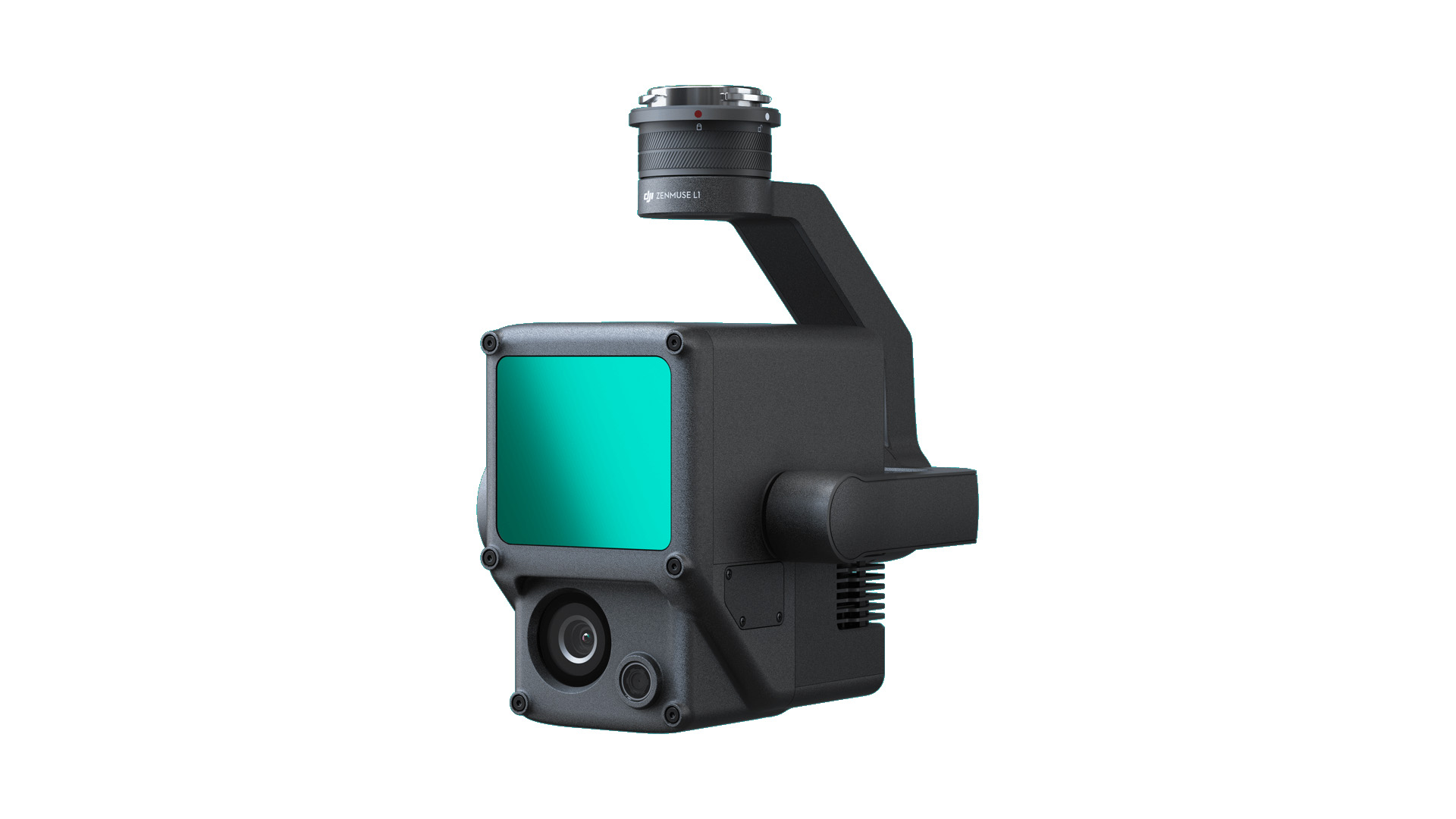
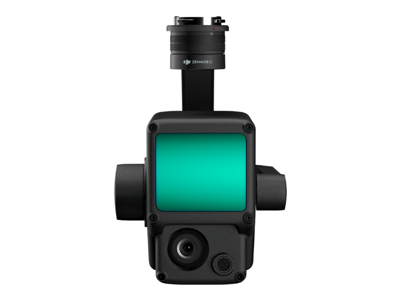
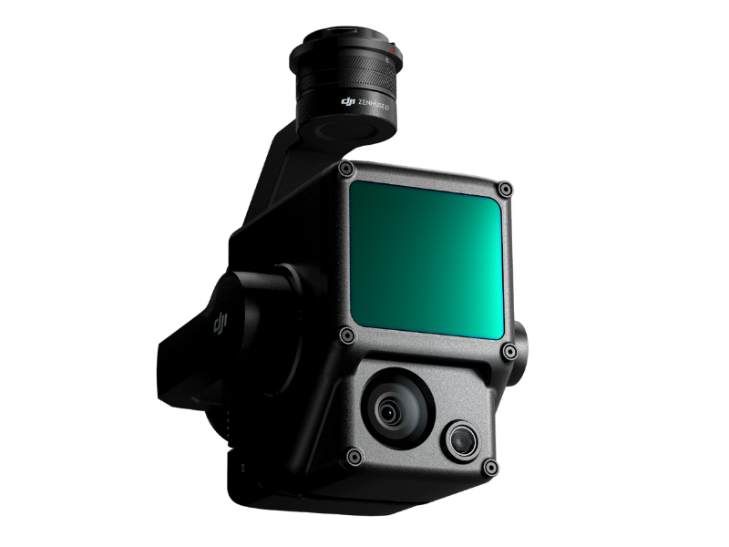
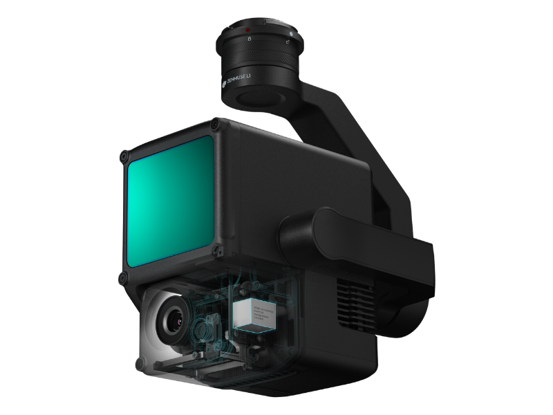
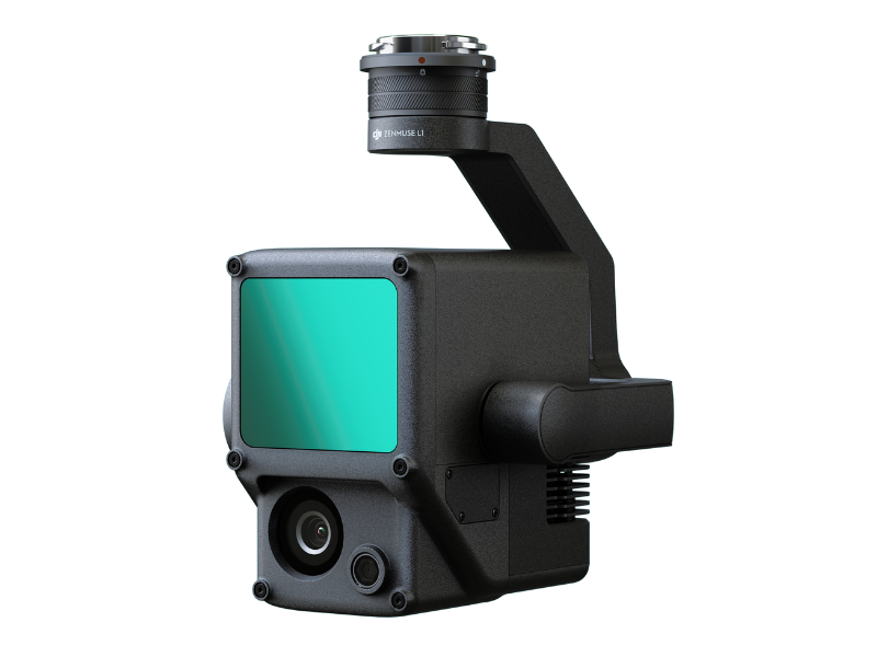
DJI Zenmuse L1
Instant Clarity. Superior Accuracy. DJI ZENMUSE L1
Price Available On Application.
A Lidar + RGB Solution for Aerial Surveying
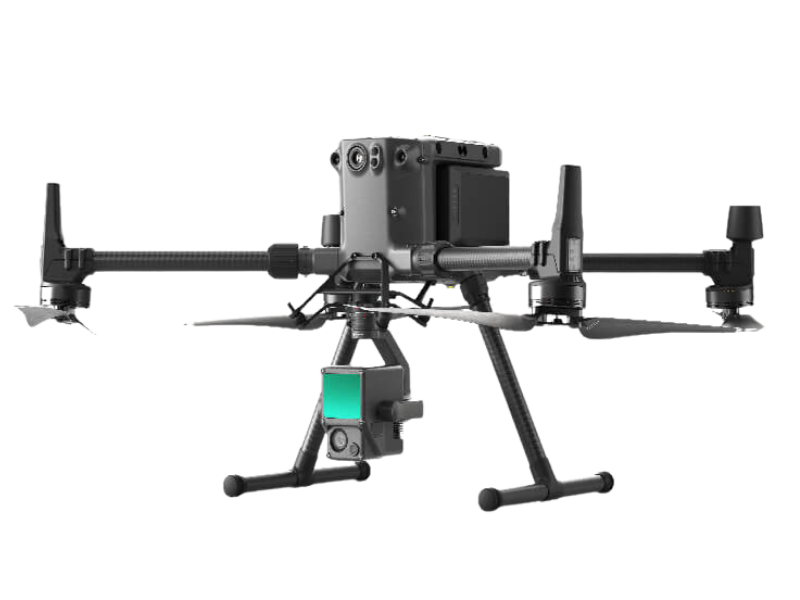
The DJI Zenmuse L1 integrates a Livox Lidar module, a high-accuracy IMU, and a camera with a 1-inch CMOS on a 3-axis stabilized gimbal. When used with Matrice 300 RTK and DJI Terra, the DJI Zenmuse L1 forms a complete solution that gives you real-time 3D data throughout the day, efficiently capturing the details of complex structures and delivering highly accurate reconstructed models.
Some Key Features – Integrates a Lidar module, an RGB camera, and a high-accuracy IMU, High Efficiency 2 km covered in a single flight, High Accuracy Vertical Accuracy: 5 cm / Horizontal Accuracy: 10 cm, Point Rate: 240,000 pts/s, Supports 3 Returns, Detection Range: 450 m (80% reflectivity, 0 klx), IP44 Ingress Protection Level & Point Cloud Live View. The Real-time point clouds provide immediate insights onsite, so operators are informed to make critical decisions quickly. You can also verify fieldwork quality by checking point cloud data immediately after each flight.
One-stop Post-processing
DJI Terra fuses the IMU and GNSS data for point cloud and visible light calculations, in addition to conducting POS data calculations so you can effortlessly generate reconstructed models and accuracy reports.
Dimensions – 152×110×169 mm
Weight – Approx. 900 g
Power – 30 W
IP Rating – IP44
Supported Aircraft – Matrice 300 RTK
Operating Temperature Range – -20° to 50° C (-4° to 122° F)
Storage Temperature Range – -20° to 60° C (-4° to 140° F)
System Performance
Detection Range
450 m @ 80% reflectivity, 0 klx;
190 m @ 10% reflectivity, 100 klx
Point Rate
Single return: 240,000 pts/s;
Multiple return: 480,000 pts/s
System Accuracy
Horizontal: 10 cm @ 50 m;
Vertical: 5 cm @ 50 m
Real-time Point Cloud Colouring Modes
True colour; colouring by reflectivity; colouring by elevation
Lidar
Ranging Accuracy – 3 cm @ 100 m
Maximum Returns Supported – 3
Scan Modes
Repetitive line scan mode, non-repetitive petal scan mode
FOV
Repetitive line scan: 70.4°×4.5°;
Non-repetitive scan: 70.4°×77.2°
Laser Safety – Class 1
Inertial Navigation System
IMU Update Frequency – 200 Hz
Accelerometer Range – ±8 g
Angular Velocity Meter Range – ±2000 dps
Yaw Accuracy – Real-time: 0.18°, Post-processing: 0.08°
Pitch / Roll Accuracy – Real-time: 0.03°, Post-processing: 0.025°
Auxiliary Positioning Vision Sensor
Resolution – 1280×960 – FOV – 95°
RGB Mapping Camera
Sensor Size – 1 inch
Effective Pixels – 20 MP
Photo Size – 4864×3648 (4:3); 5472×3648 (3:2)
Focal Length – 8.8 mm / 24 mm (Equivalent)
Shutter Speed
Mechanical Shutter Speed: 1/2000 – 8 s
Electronic Shutter Speed: 1/8000 – 8 s
ISO
Video: 100 – 3200 (Auto), 100 – 6400 (Manual)
Photo: 100 – 3200 (Auto), 100 – 12800 (Manual)
Aperture Range – f/2.8 – f/11
Gimbal – Stabilized System 3-axis (tilt, roll, pan)
Angular Vibration Range – 0.01°
Mount – Detachable DJI SKYPORT
Mechanical Range – Tilt: -120° to +30°; Pan: ±320°
Operation Modes – Follow/Free/Re-centre
Data Storage – Raw Data Storage
Photo/IMU/Point cloud data storage – Point Cloud Data Storage – Real-time modelling data storage
Supported microSD Cards – microSD: Class 10 or UHS-1 rating or above; Max capacity: 256 GB
Post-processing Software – Supported Software – DJI Terra
Data Format
DJI Terra supports exporting standard format point cloud models:
Point cloud format: PNTS/LAS/PLY/PCD/S3MB format
Reconstruction model format: B3DM/OSGB/PLY/OBJ/S3MB format
1 x Gimbal and Camera
1 x MicroSD card 32GB)
1 x Storage Case
1 x Lens Cleaning Cloth
1 x DJI Terra Activation Code (6 Months)