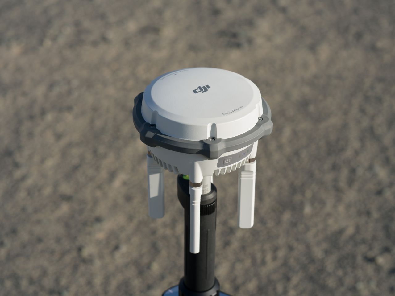
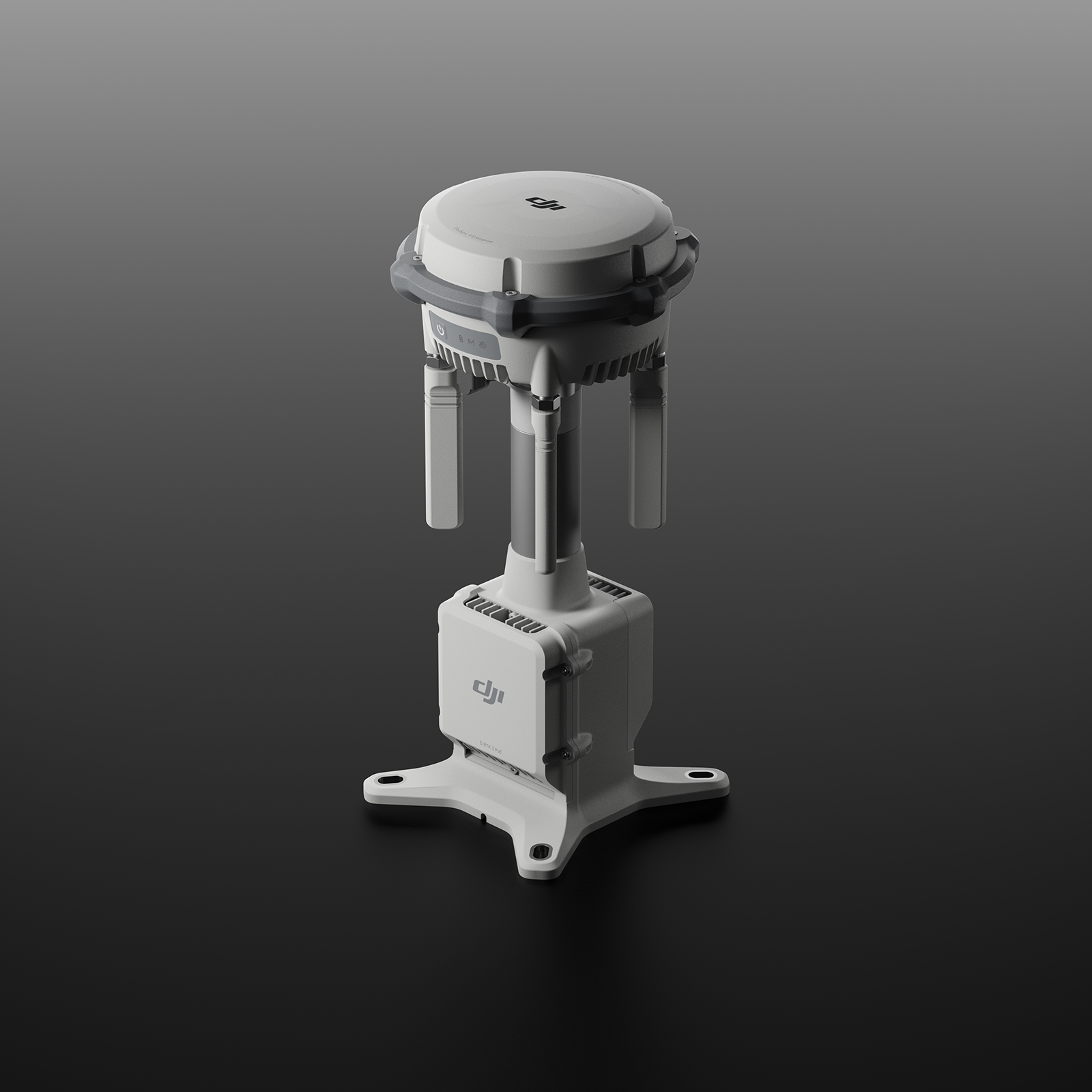
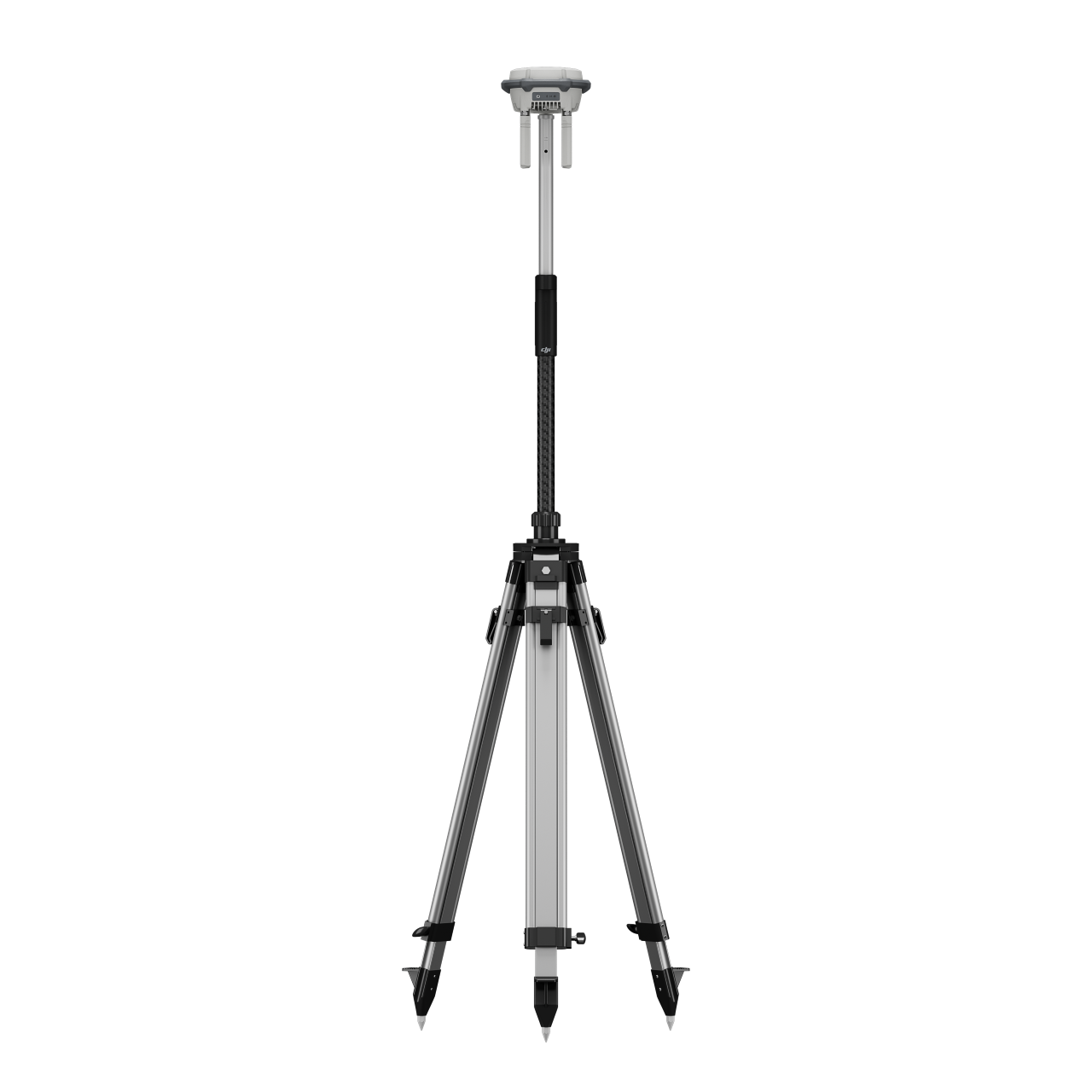
D-RTK 3 Base Station

DJI D-RTK 3 Base Station & Relay
High-Precision RTK Positioning and Communication Support
The DJI D-RTK 3 is a high-precision GNSS base station and relay system designed to enhance positioning accuracy, signal reliability, and operational range for DJI enterprise drone operations. Built for professional surveying, mapping, inspection, and public safety missions, the D-RTK 3 provides stable RTK correction data and robust communication support in challenging environments.
By supporting both RTK base station and relay station modes, the D-RTK 3 enables flexible deployment across a wide range of operational scenarios.
Key Capabilities
Centimetre-Level RTK Positioning Support
- Provides real-time correction data for RTK-enabled DJI enterprise aircraft
- Improves positional accuracy for mapping, LiDAR, and inspection workflows
- Supports consistent, repeatable results for professional operations
Flexible Base Station Operation
- Reduces reliance on mobile network coverage or third-party RTK services
- Ideal for remote or connectivity-limited environment
- Can be deployed as a local GNSS reference station on site.
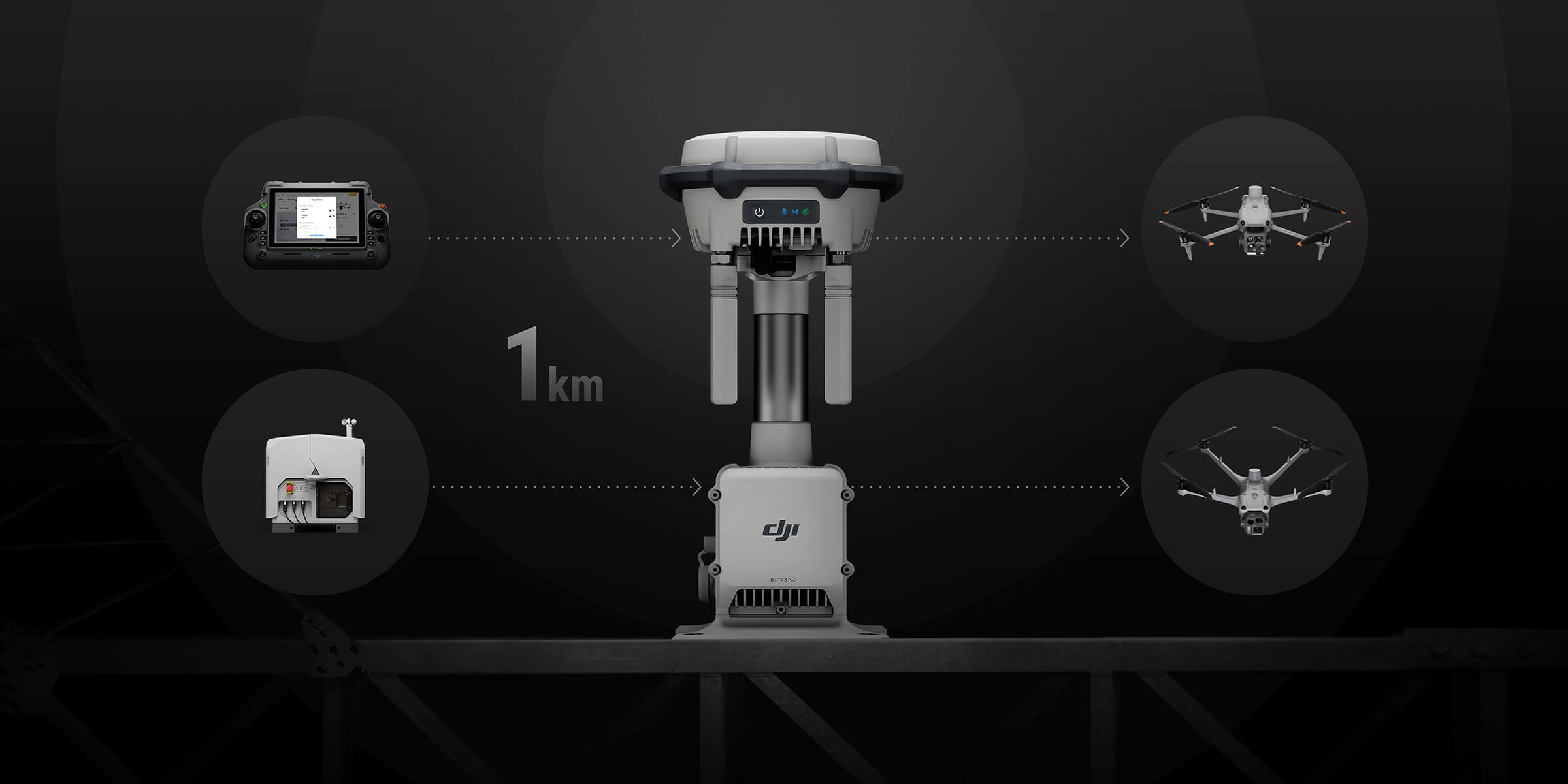
Relay Station Functionality
- Operates as a relay to extend aircraft communication range
- Improves signal stability in complex terrain or obstructed environments
- Enhances operational safety and reliability during long-range missions
Multi-Constellation GNSS Support
- Receives signals from multiple satellite systems
- Improves positioning stability and availability
- Supports reliable RTK performance in varied geographic conditions
Enterprise Integration
- Seamlessly integrates with DJI enterprise aircraft and controllers
- Supports DJI Pilot 2 and DJI FlightHub 2 workflows
- Designed for rapid deployment in field operations
Designed for Professional Survey and Inspection Workflows
The DJI D-RTK 3 primary function its to keep a stable RTK connection to the UAS while in Flight. The DJI D-RTK 3 is engineered to support regulated and mission-critical operations, making it a valuable tool for surveyors, engineers, utilities, and public safety organisations. Its dual-mode functionality allows teams to adapt quickly to site conditions while maintaining high levels of accuracy and communication reliability.
Typical Applications
- High-accuracy aerial surveying and mapping
- LiDAR and photogrammetry workflows
- Long-range infrastructure inspection
- Operations in remote or low-connectivity areas
- Public safety and emergency response missions
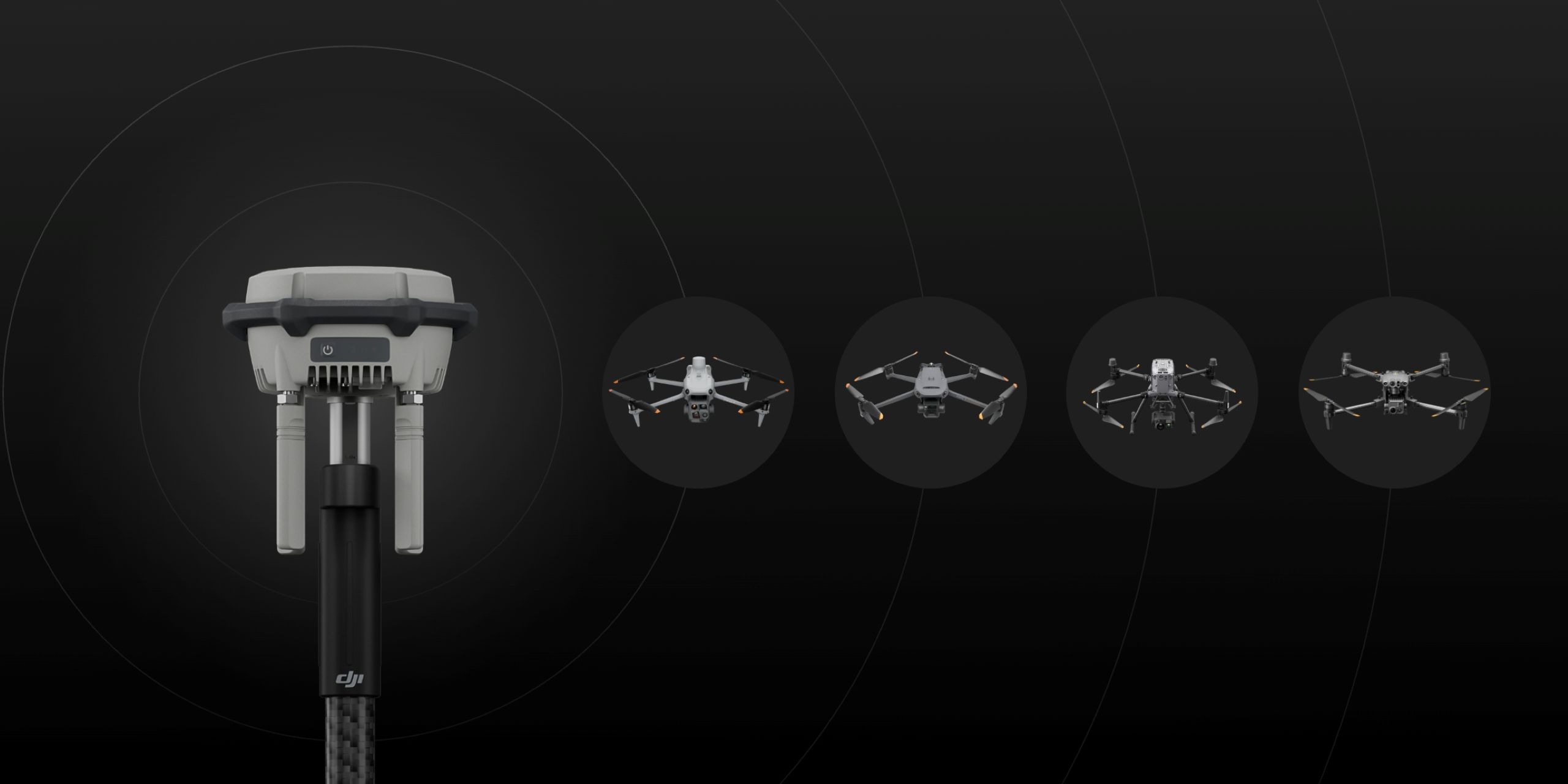
Compatibility for Drones.
Enterprise
Matrice 400
Matrice 4E, Matrice 4T
Matrice 4D, Matrice 4TD (DJI RC Plus 2 Enterprise)
Matrice 3D/3TD (DJI RC Pro Enterprise)*
Matrice 300/350 RTK*
Matrice 30 Series*
Mavic 3 Enterprise Series*
Agriculture
T60*
T50/T25*
T40/T20P*
DJI FlyCart 30*
Professional Filmmaking
DJI Inspire 3*
* Currently, only manual D-RTK 3 position calibration is supported. Please refer to official updates for future feature enhancements.
Relay Station Mode [2]
Matrice 4E, Matrice 4T
Matrice 4D, Matrice 4TD (DJI RC Plus 2 Enterprise)
Relay Station Mode [2]:
DJI Dock 3
Matrice 4E, Matrice 4T*
Matrice 4D, Matrice 4TD (DJI RC Plus 2 Enterprise)
* All relay stations, aircraft, and remote controllers need to be updated to version V13.01.00.04 or later and connected via Remote Access
For More Info Contact Us!
DJI D-RTK 3 — Technical Specifications.
General
- Product Type: High-precision GNSS base station and relay station
- Primary Function: RTK positioning reference and signal relay for DJI enterprise aircraft
- Supported Aircraft:
-
- Matrice 400
- Matrice 4E, Matrice 4T
- Matrice 4D, Matrice 4TD (DJI RC Plus 2 Enterprise)
- Matrice 3D/3TD (DJI RC Pro Enterprise)*
- Matrice 300/350 RTK*
- Mavic 3 Enterprise Series*
- Matrice 30 Series*
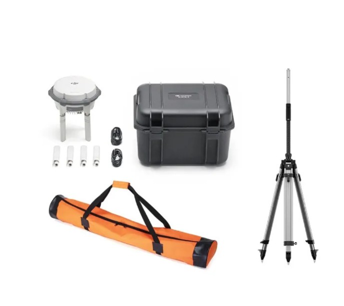
Mounting Options: Tripod mount, fixed installation, mobile deployment
GNSS System
- Satellite Systems Supported:
- GPS
- Galileo
- BeiDou
- GLONASS
- Frequency Bands: Multi-frequency GNSS reception
- Positioning Mode: RTK base station, relay station, or rover (workflow dependent)
Positioning Performance
- RTK Accuracy (Typical):
- Horizontal: centimetre-level (workflow dependent)
- Vertical: centimetre-level (workflow dependent)
Note: DJI does not specify a single fixed accuracy value, as RTK performance depends on satellite conditions, installation, baseline distance, and operational workflow.
Communication & Transmission
- Transmission Type: DJI enterprise data link
- Relay Function:
- Can operate as a relay station to extend aircraft communication range
- Improves signal stability in complex terrain or obstructed environments
- Multi-Device Support: Supports connection to multiple aircraft or controllers (mission dependent)
Power & Battery
- Power Supply:
- Internal battery
- External power input (continuous operation support)
- Operating Time: Designed for extended field operations (battery and power source dependent)
- Charging: USB-C / external power (model dependent)
Data & Integration
- RTK Data Output: Real-time correction data for aircraft positioning
- System Integration:
- DJI Pilot 2
- DJI FlightHub 2
- Compatible with DJI enterprise RTK workflows
- Network RTK Support: Can be used alongside network RTK services where available
Physical Characteristics
- Design: Rugged, portable enclosure for field deployment
- Environmental Protection: Designed for outdoor professional use
- Indicators: Status LEDs for power, GNSS lock, and RTK status
Operating Environment
- Operating Temperature: -20 °C to 50 °C
- Storage Temperature: -20 °C to 60 °C
The DJI D-RTK 3 is a high-precision GNSS base and relay station designed to support centimetre-level RTK positioning for DJI enterprise drone operations. By providing stable correction data and optional relay functionality, the D-RTK 3 enhances positional accuracy, flight reliability, and operational range in surveying, mapping, inspection, and public safety missions. Its flexible deployment options make it well suited to both fixed-site and mobile field operations.
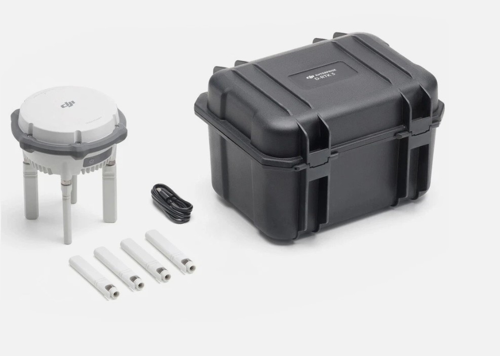
There is a Combo Option, see below.