DJI Zenmuse L2
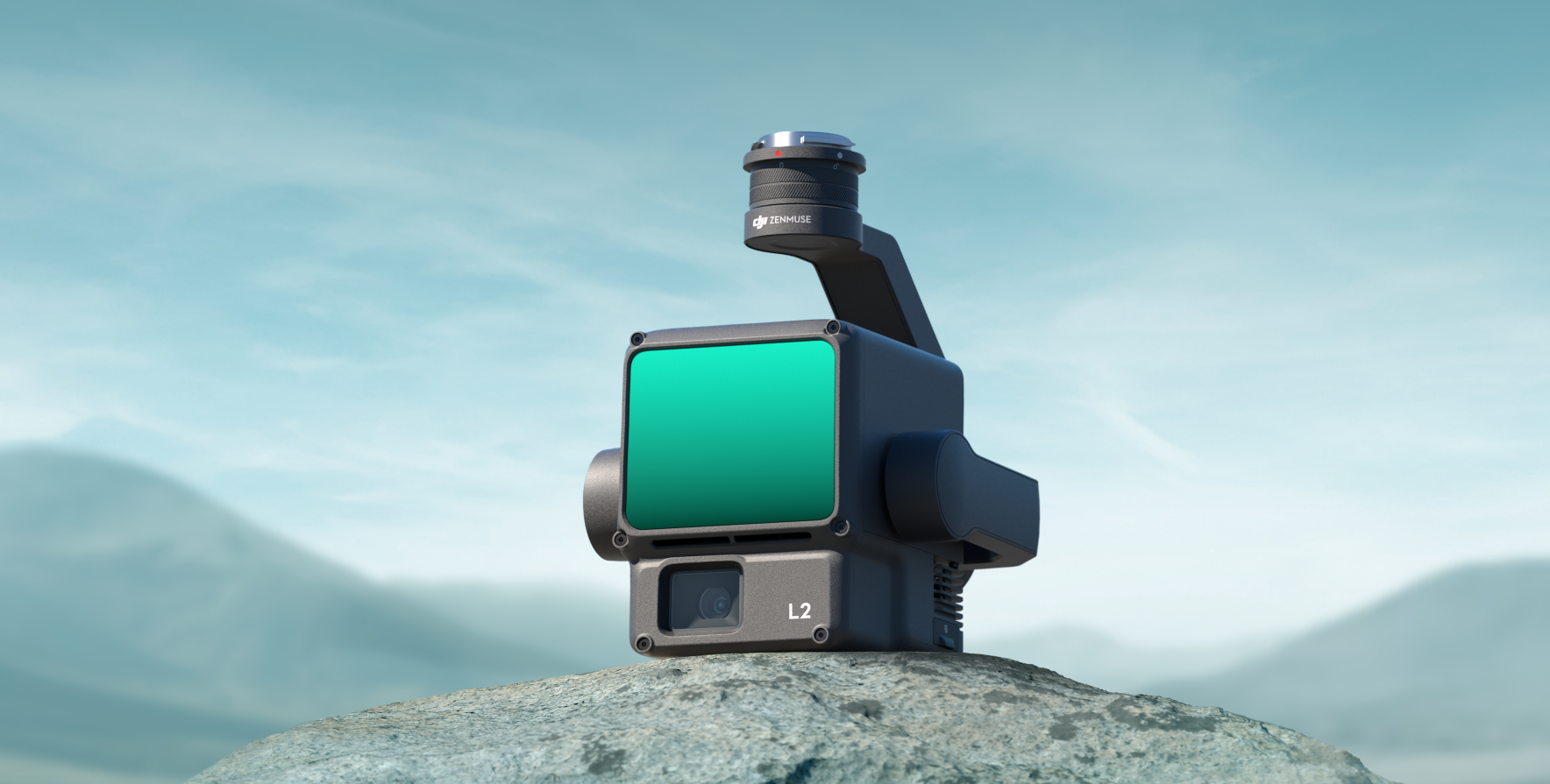


DJI Zenmuse L2
Integrated Aerial LiDAR and RGB Mapping Sensor
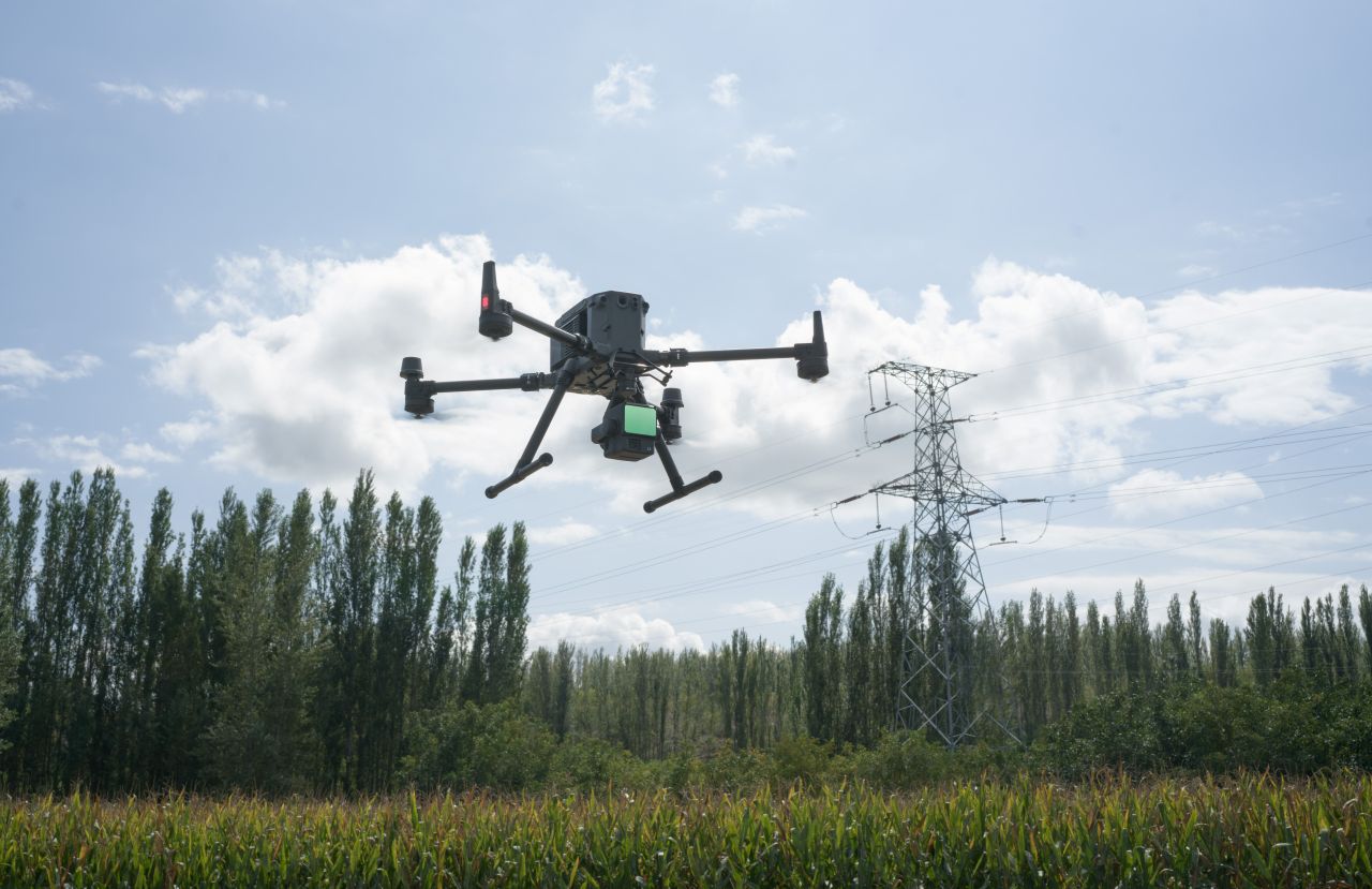
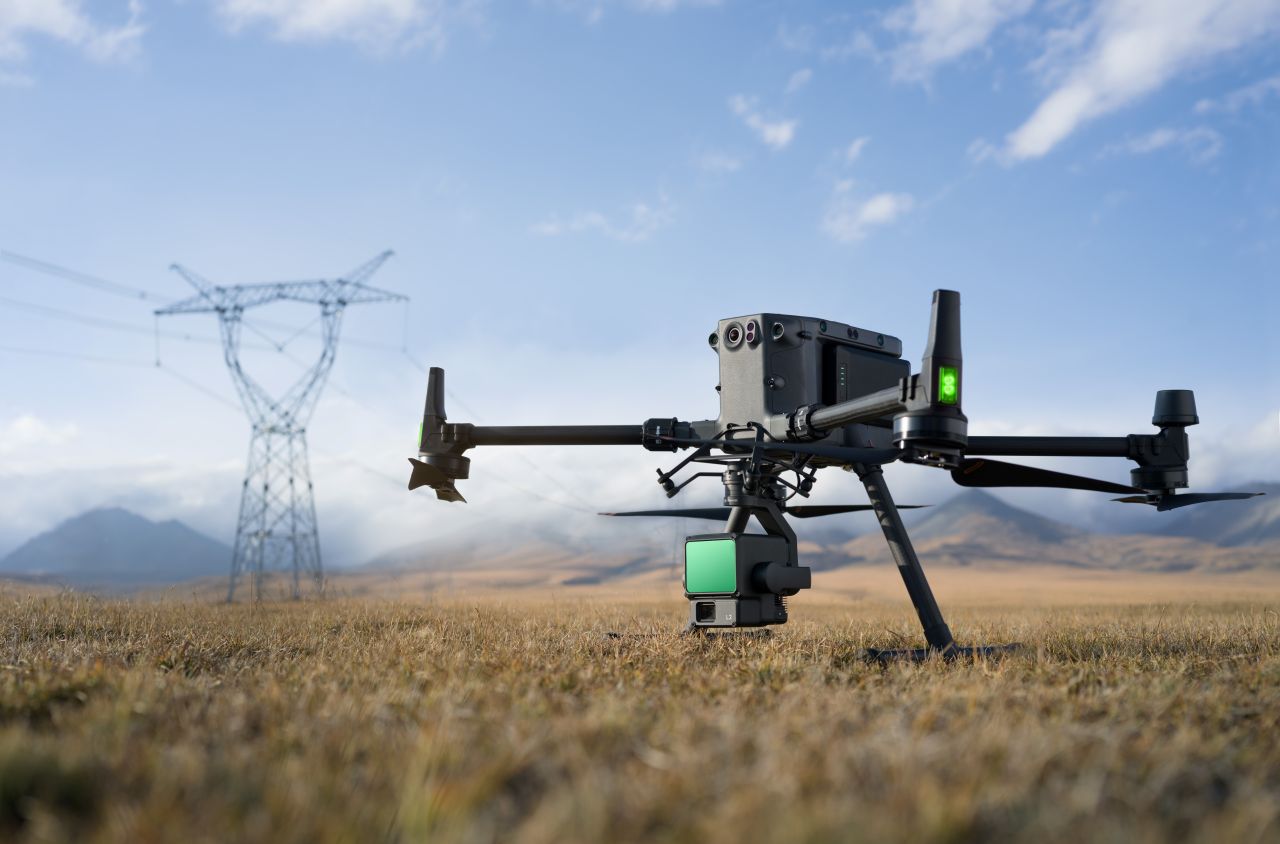
The DJI Zenmuse L2 is an integrated LiDAR and RGB mapping sensor designed for surveying, inspection, and terrain modelling. Combining LiDAR, a high-resolution RGB camera, and an advanced positioning system into a single payload, the L2 enables efficient and accurate 3D data capture across a wide range of professional applications.
Optimised for use with DJI enterprise aircraft, the Zenmuse L2 delivers reliable spatial data in complex environments, including areas with vegetation, uneven terrain, and linear infrastructure.
Key Capabilities
Integrated LiDAR Mapping
- Captures dense 3D point clouds for terrain and asset modelling
- Penetrates vegetation to record ground elevation beneath canopy
- Suitable for topographic surveys, corridor mapping, and earthworks analysis
High-Resolution RGB Imaging
- Integrated RGB camera provides colourised point clouds and visual context
- Supports improved interpretation, classification, and reporting
- Enables combined LiDAR and photogrammetry workflows
Efficient Survey Operations
- High data capture efficiency reduces flight time and site visits
- Supports automated mission planning and repeatable survey patterns
- Ideal for large-area and linear infrastructure projects
Precision Positioning
- Integrated IMU with RTK support when paired with compatible aircraft
- Enables accurate georeferencing for professional LiDAR workflows
- Reduces reliance on extensive ground control networks
Enterprise-Grade Integration
- Designed for seamless operation with DJI enterprise platforms
- Supports DJI Pilot 2, DJI Terra, and third-party processing software
- Built to meet the needs of regulated and mission-critical operations
Designed for Professional Surveying and Inspection
The DJI Zenmuse L2 is engineered for organisations that require reliable 3D spatial data without the complexity of multi-sensor setups. Its integrated design, operational efficiency, and consistent performance make it a strong solution for surveyors, engineers, utilities, and environmental professionals operating in demanding environments.
Typical Applications
- Topographic and terrain surveying
- Corridor and linear infrastructure mapping
- Forestry and vegetation analysis
- Construction and earthworks monitoring
- Utility and asset inspection
For More Info Contact Us!
DJI Zenmuse L2 — Technical Specifications
General
- Sensor Type: Integrated aerial LiDAR and RGB mapping sensor
- Compatible Aircraft: DJI Matrice 300 RTK, DJI Matrice 350 RTK
- Mount: DJI Single & Dual Gimbal Mount
- Ingress Protection: IP4X (when mounted on aircraft)
LiDAR System
- Laser Wavelength: 905 nm
- Scanning Pattern: Non-repetitive & Repetitive scanning
- Repetitive scanning pattern: Horizontal 70°, Vertical 3°
Non-repetitive scanning pattern: Horizontal 70°, Vertical 75° - Max Detection Range:
- Up to 250 m @ 10% reflectivity
- Up to 450 m @ 50% reflectivity
- Point Rate: Up to 240,000 points per second
- Returns per Pulse: Up to 5 returns
- Ranging Accuracy: ±5 cm (typical, workflow dependent)
RGB Camera (Colourisation & Context)
- Sensor: 4/3″ CMOS
- Effective Pixels: 20 MP
- Image Resolution: 5280 × 3956
- Photo Formats: JPEG
- Purpose: Point cloud colourisation and visual reference imagery
Mapping & Survey Performance
- Typical Survey Altitude: 30–120 m AGL (mission dependent)
- Horizontal Accuracy: Survey-grade (workflow dependent)
- Vertical Accuracy: Survey-grade (workflow dependent)
- Max Operating Speed: Up to 15 m/s (mission dependent)
- Coverage Efficiency: Optimised for terrain, corridor, and asset mapping
Positioning & Synchronisation
- IMU: High-precision integrated IMU
- TimeSync: Supported (LiDAR, RGB camera, IMU, and aircraft RTK synchronised)
- Georeferencing: Direct georeferencing via aircraft RTK
Gimbal & Stabilisation
- Stabilisation: 3-axis mechanical gimbal (tilt, roll, pan)
- Mounting Configuration: Single downward gimbal
Data & Workflow
- Data Storage: microSD card
- Supported Software:
- DJI Pilot 2 (data capture)
- DJI Terra (LiDAR processing and point cloud generation)
- Third-party LiDAR processing software (LAS/LAZ compatible)
- Output Formats: LAS / LAZ / PLY and derived mapping products
Operating Environment
- Operating Temperature: -20 °C to 50 °C
- Storage Temperature: -20 °C to 60 °C
