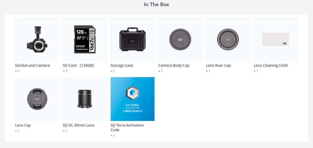
DJI Zenmuse P1
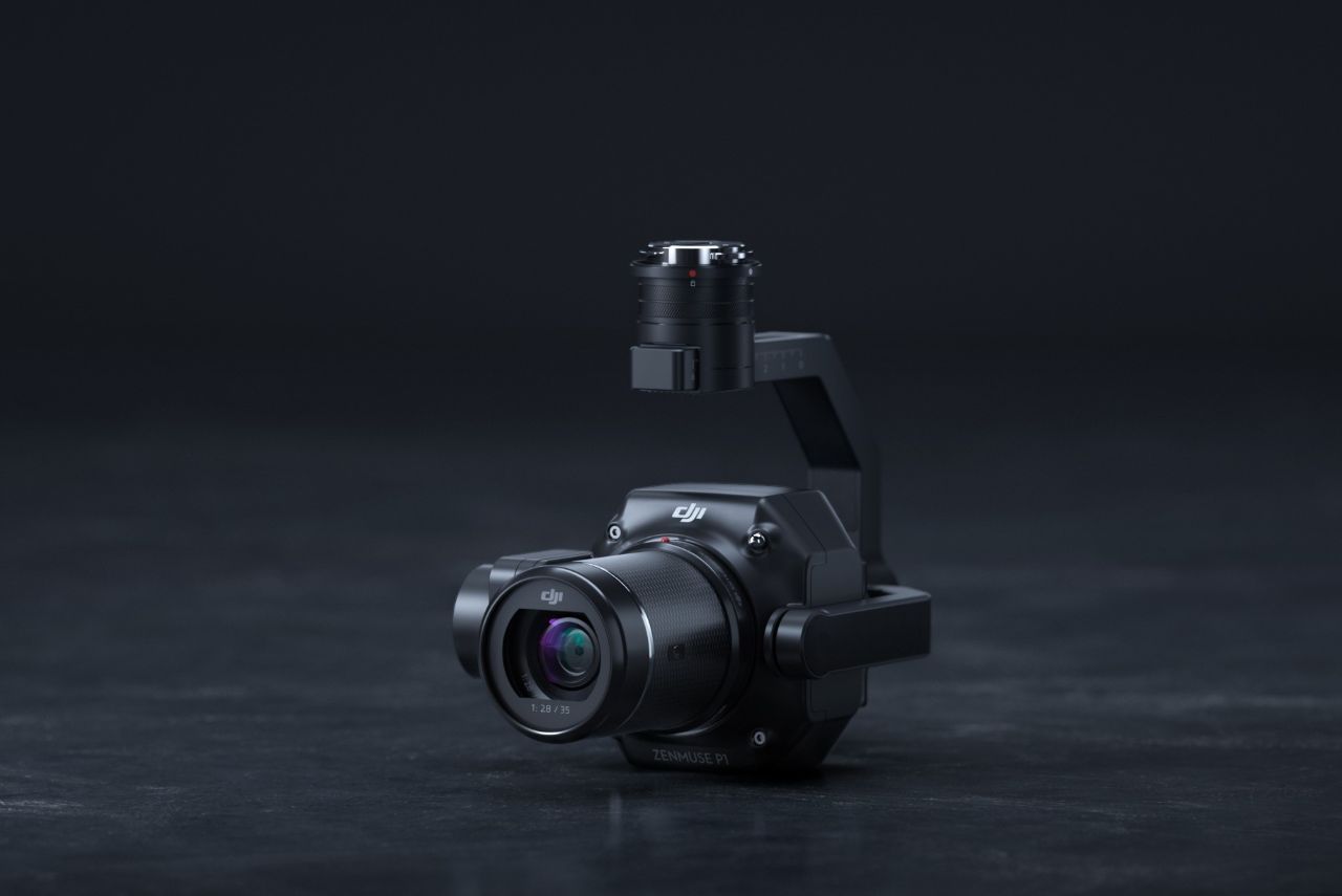

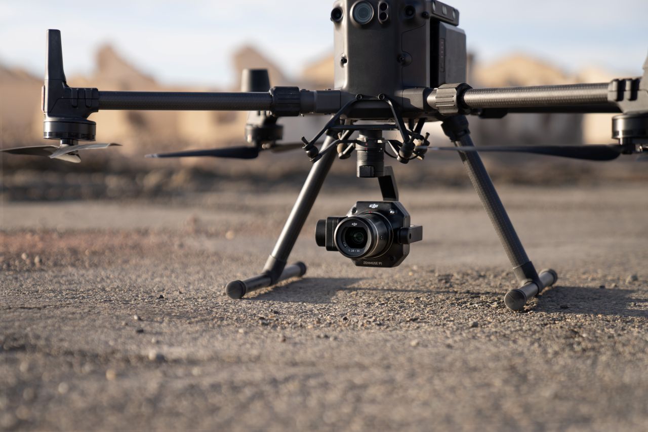
DJI Zenmuse P1
Full-Frame Aerial Photogrammetry Sensor
The DJI Zenmuse P1 is a full-frame aerial photogrammetry sensor designed for high-accuracy surveying and mapping missions. Engineered for use with DJI enterprise platforms, the P1 delivers exceptional image quality, precision, and efficiency for large-scale mapping projects.
By combining a full-frame CMOS sensor with intelligent capture capabilities, the Zenmuse P1 enables professional surveyors to collect reliable geospatial data with fewer flights and reduced time on site.
Key Capabilities
Full-Frame Photogrammetry Imaging
- 45 MP full-frame CMOS sensor delivers high-resolution imagery
- Large sensor size improves detail, dynamic range, and low-light performance
- Supports survey-grade orthomosaics and 3D reconstruction
Mechanical Global Shutter
- High-speed global shutter eliminates motion blur and rolling-shutter distortion
- Enables fast flight speeds while maintaining image accuracy
- Ideal for corridor mapping and large-area surveys
Interchangeable Lenses
- Supports multiple DJI DL prime lenses
- Allows optimisation for different altitudes, GSD requirements, and project types
- Increases flexibility across surveying applications
High-Efficiency Data Capture
- Smart oblique and orthogonal capture modes
- Covers large areas per flight, reducing operational time and cost
- Consistent image geometry improves downstream processing results
Precision Positioning
- Integrated TimeSync and RTK support when paired with compatible aircraft
- Delivers accurate geotagging for professional photogrammetry workflows
- Reduces dependence on extensive ground control networks
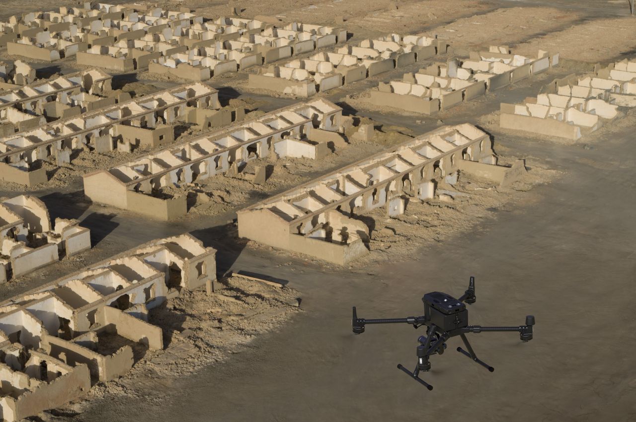
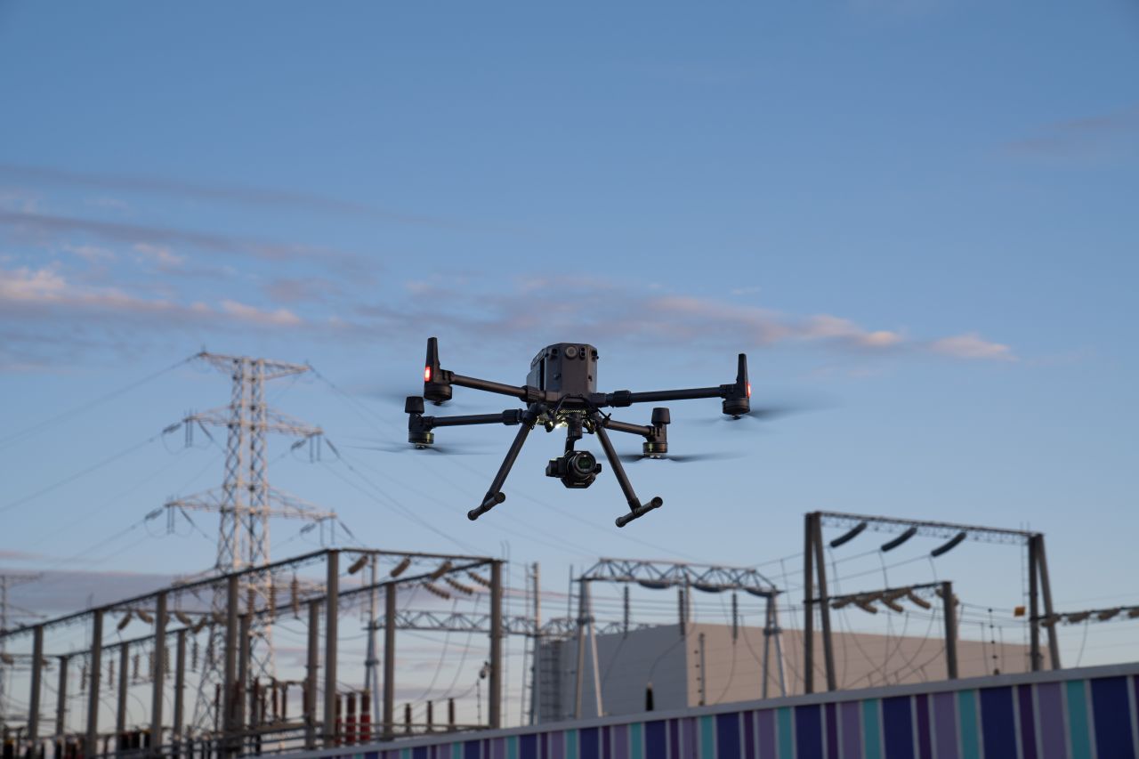
Designed for Professional Surveying
The DJI Zenmuse P1 is built to meet the demands of commercial surveying, engineering, and mapping operations, particularly where accuracy, efficiency, and repeatability are critical. When combined with DJI enterprise aircraft, it provides a powerful aerial data capture solution suitable for land surveying, construction mapping, and infrastructure projects.
Typical Applications
- Large-scale topographic and land surveys
- Corridor mapping and linear infrastructure
- Construction and earthworks monitoring
- Urban mapping and 3D city modelling
- Engineering and geospatial data capture
DJI Zenmuse P1 Camera Efficiency Through Flexible Full-Frame Photogrammetry
Price Available On Application. Please Fill Out The Inquiry Form And We Will Guide You With Professional Advice And All Other Relevant Information.
If you need further advice on this product please send an email to info@surveydrones.ie or fill in the contact page on this website.
DJI Zenmuse P1 — Technical Specifications
General
- Sensor Type: Aerial photogrammetry camera
- Compatible Aircraft: DJI Matrice 300 RTK, DJI Matrice 350 RTK, M400
- Mount: DJI SkyPort
- Ingress Protection: IP4X (when mounted on aircraft)
Camera & Imaging
- Sensor: Full-frame CMOS
- Effective Pixels: 45 MP
- Sensor Size: 35.9 × 24.0 mm
- Pixel Size: 4.4 μm
- Max Image Resolution: 8192 × 5460
- Photo Formats: JPEG, DNG (RAW)
- Colour Mode: RGB
Shutter & Performance
- Shutter Type: Mechanical global shutter
- Max Shutter Speed: 1/2000 s
- Min Shutter Interval:
- 0.7 s (single gimbal)
- 0.8 s (dual gimbal)
- Max Continuous Shooting Speed: ~1 photo per second
Lens Compatibility
Supports DJI DL interchangeable lenses:
- DJI DL 24 mm F2.8 LS ASPH
- DJI DL 35 mm F2.8 LS ASPH
- DJI DL 50 mm F2.8 LS ASPH
Lens selection allows optimisation for altitude, GSD, and project scale.
Photogrammetry & Mapping Performance
- Recommended Flight Speed: Up to 15 m/s (mapping dependent)
- High Efficiency Capture:
- Covers up to 3 km² in a single flight (at 120 m AGL, GSD ~3 cm)
- Capture Modes:
- Orthogonal mapping
- Smart oblique capture
Positioning & Accuracy
- Geotagging: High-precision positioning via aircraft RTK
- TimeSync: Yes (camera, RTK, and flight controller synchronised)
- Horizontal Accuracy: Centimetre-level (with RTK and proper workflow)
- Vertical Accuracy: Centimetre-level (with RTK and proper workflow)
Gimbal & Stabilisation
- Stabilisation: 3-axis mechanical gimbal (tilt, roll, pan)
- Angular Vibration Range: ±0.01°
- Mounting: Single or dual downward gimbal configuration
Operating Environment
- Operating Temperature: -20 °C to 50 °C
- Storage Temperature: -20 °C to 60 °C