DJI Matrice 4D (Standalone)
DJI Matrice 4D (Standalone)
Enterprise-Grade Aerial Intelligence Platform
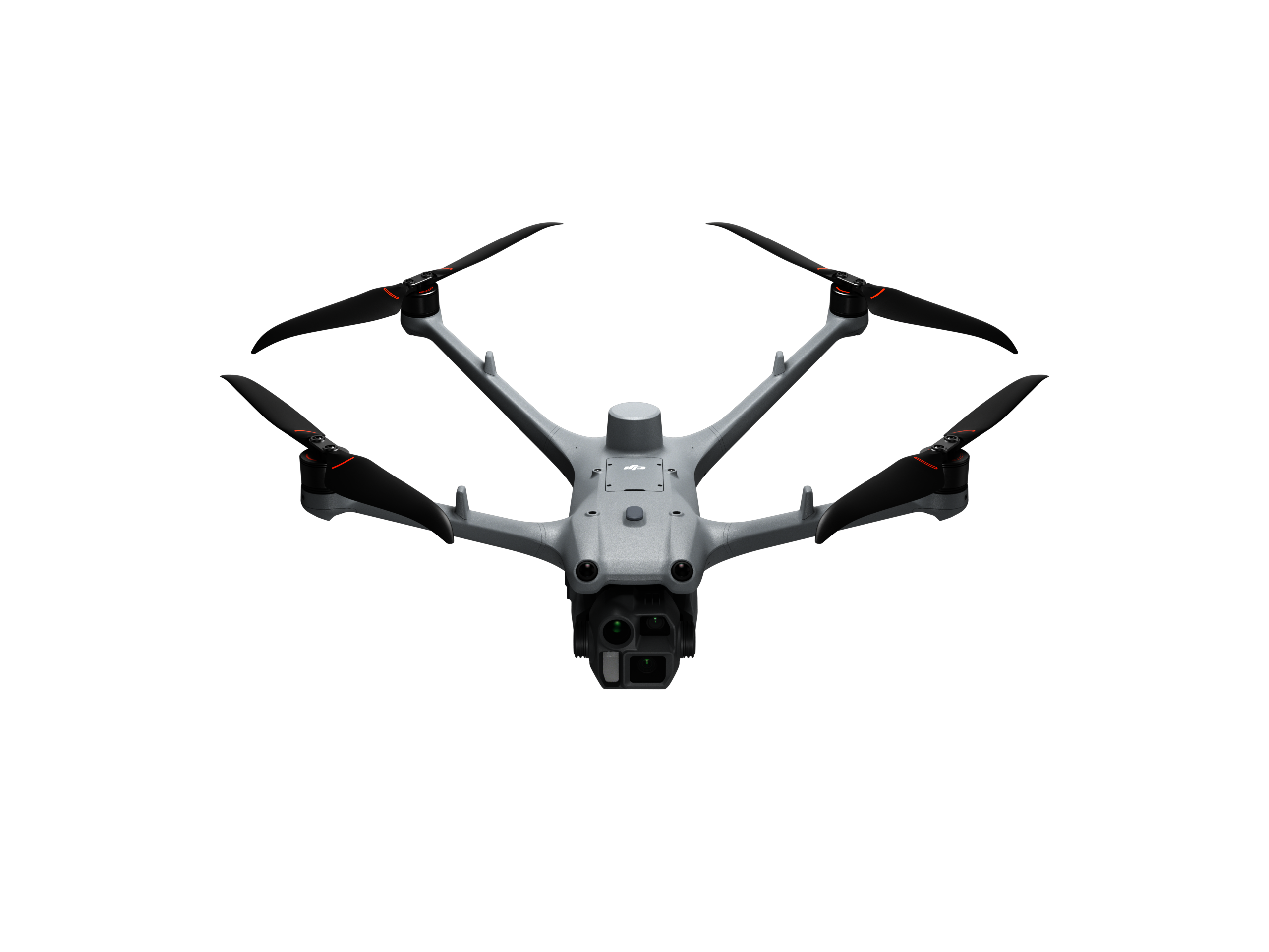
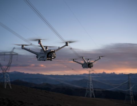
The DJI Matrice 4D (M4D) is a next-generation, enterprise-class unmanned aircraft designed for high-precision mapping, inspection, and situational awareness. Built for demanding professional operations, the M4D combines advanced multi-sensor imaging, robust flight performance, and intelligent automation in a compact and highly capable platform.
Optimised for standalone operations, the Matrice 4D delivers reliable, repeatable, and accurate aerial data across a wide range of industries including surveying, infrastructure inspection, public safety, utilities, and environmental monitoring.
Key Capabilities
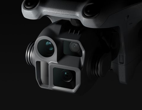
Multi-Sensor Payload
- Integrated wide-angle camera for area coverage and mapping
- Medium telephoto camera for detailed inspection at safe distances
- Long-range telephoto camera for precision observation and asset assessment
- High-resolution imaging supports accurate data capture for professional analysis and reporting
Precision Mapping & Surveying
- Designed to support photogrammetry and mapping workflows
- High positional accuracy when combined with RTK workflows
- Suitable for corridor mapping, site surveys, volumetric analysis, and asset inventories
Advanced Inspection Performance
- Optical zoom enables close-up inspection without proximity risk
- Ideal for power infrastructure, telecoms, buildings, bridges, and industrial assets
- Reduced need for repeat flights through intelligent framing and sensor flexibility
Intelligent Flight & Safety Systems
- Omnidirectional obstacle sensing for enhanced situational awareness
- Stable flight performance in challenging environments
- Intelligent return-to-home and failsafe systems support operational safety
Operational Efficiency
- Fast deployment and streamlined setup
- Designed for single-crew or small-team operations
- Efficient data capture reduces time on site and operational overhead
Designed for Professional Operations
The Matrice 4D is engineered to meet the needs of regulated and mission-critical UAS operations, offering a balance of performance, reliability, and flexibility. Its modular, enterprise-focused design makes it well suited for organisations requiring consistent results, operational resilience, and scalable deployment.
Whether deployed for detailed inspections, large-area mapping, or rapid situational assessment, the M4D provides operators with a powerful and dependable aerial platform.
Typical Applications
- Surveying & mapping
- Infrastructure & asset inspection
- Utilities & energy
- Construction & engineering
- Environmental monitoring
- Public safety & emergency response
For More Info Contact Us!
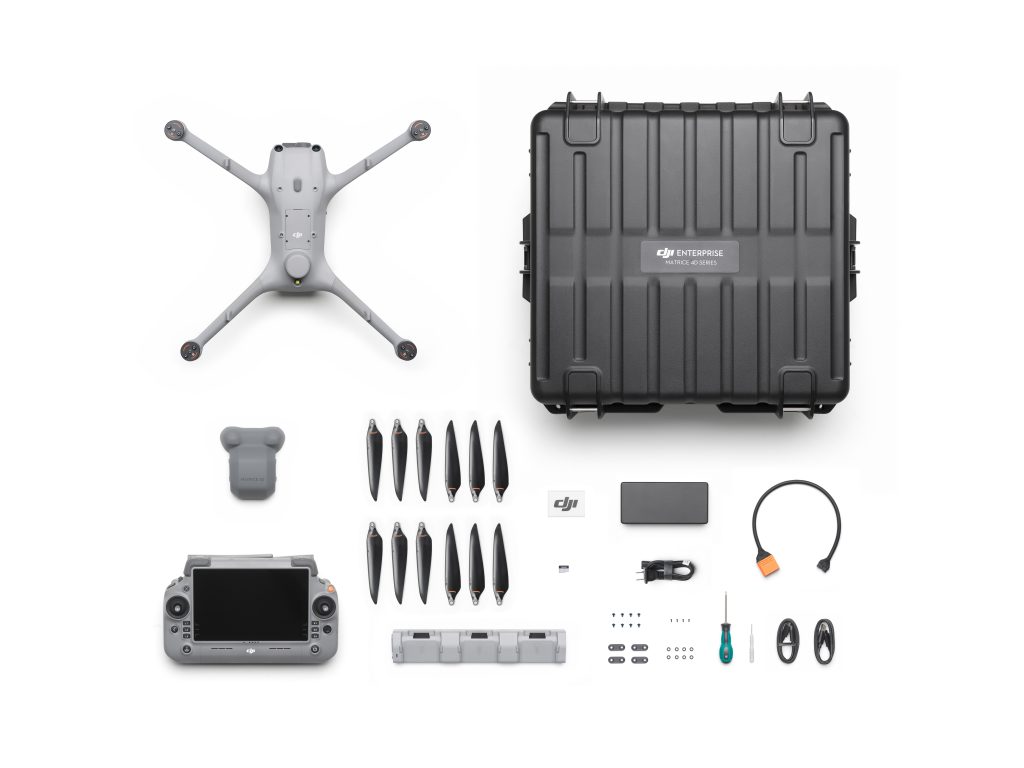
DJI Matrice 4D (M4D) — Key Specifications
Aircraft & Performance
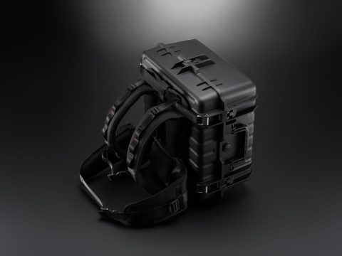
- IP Rating: IP55 (dust and water resistance) for industrial deployment.
- Flight Time: Up to ~47 minutes (hover) and up to ~54 minutes in forward flight.
- Operational Modes: Standalone with RC Plus 2 or automated via DJI Dock 3.
Sensor & Payload
- Triple-Camera System:
- Wide-angle camera
- 1/1.3″ 48 MP medium tele camera
- 1/1.5″ 48 MP telephoto camera
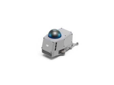
- Laser Range Finder: Built-in LRF for distance measurement, mapping, and inspection tasks.
- Mapping & Imaging: Suitable for high-precision photogrammetry and visual data capture with automated terrain following and oblique photography support.
Core Features
- Advanced obstacle sensing and navigation suite.
- Full-colour night mode and AI-based object recognition.
- All-weather capability thanks to IP55 protection.
DJI Matrice 4TD (M4TD) — Key Specifications
Aircraft & Performance
- IP Rating: IP55 (dust and water resistance).
- Flight Time: Up to ~47 minutes (hover) and up to ~54 minutes in forward flight.
Sensor & Payload
- Multi-camera Configuration:
- Wide-angle, medium tele and telephoto optical cameras (as M4D)
- Infrared Thermal Camera:
- Resolution: 640 × 512 thermal sensor
- Optimised for thermal inspection, night ops and situational awareness.
- NIR Auxiliary Light: Enhances low-light imaging.
- Laser Range Finder: Included for precise measurement and mapping.
Core Features
- Thermal capability: Extended use for emergency response, public safety, and utility inspections.
- Same endurance and platform performance as the M4D.
Shared Common Specifications (M4D & M4TD)
| Category | Specification |
| IP Protection | IP55 water & dust resistant (industrial grade) |
| Flight Endurance | ~47 min hover / ~54 min forward flight |
| Controller Compatibility | DJI RC Plus 2 Enterprise |
| Automation & Integration | DJI Dock 3 autonomous operations |
| Operational Roles | Mapping, inspection, surveillance, public safety |
Notes & Tips
- The M4TD adds thermal imaging and NIR lighting on top of the M4D’s optical suite — ideal where infrared data is essential.
- IP55 rating means dust protection and resistance to light jets of water — crucial for outdoor industrial environments.
Both models excel in extended missions, especially when used with DJI’s Dock 3 for autonomous or remote deployments